Bike Tripper
Have Bikes, Will Travel
Bike Trail Maps & Photos Galore
You are here > Home >
Great Smoky Mountains
Latest update: September 2024
Best Biking... Great Smoky Mountains National Park
Safe, Fun Recreational Biking
All Park roads are officially open to bikes, but we do not recommend biking on the busy main roads. Here we provide first-hand reports on 4 Park areas where we have found recreational biking to be safe and fun. All reports contain e-z open maps and photos:
- Cades Cove (most popular)
- Cataloochee Valley
- Roaring Fork Motor Nature Trail
- Tremont (Middle Prong, Little River).
Also consider the paved
Townsend
Historical Trail located in Townsend, TN, immediately adjacent
to a Park entrance (near Tremont and Cades Cove). We now include reports on 5 popular hikes.
Note: there are no mountain biking trails
in the National Park. Weather and repairs often cause closures.
Always check for alerts and closures

Location: Great Smoky Mountains National Park,
Tennessee and North Carolina (See map)
Distance: Various
Surface: Paved and unpaved roads
E-bikes: Only Class 1 and 2 electric bikes are permitted.
Park Fees: No entrance fee but
parking
tag is required for vehicles
parking 15 minutes or more anywhere in the Park.
Shuttles:
At times, parking lots can be
full. Several
shuttle services are available.
Page Summary:
- Biking at Great Smoky Mountains National Park
- Cades Cove
- Tremont and Middle Prong Little River
- Roaring Fork Motor Nature Trail
- Cataloochee Valley - Hiking at Great Smoky Mountain National Park
- Kuwohi (Clingmans Dome)
- Newfound Gap - Appalachian Trail
- Elkmont - Little River Trail
- Laurel Falls Trail
- Fontana Dam - More Information and Resources
Best Recreational Biking ... Great Smoky Mountains National Park
The most visited National Park in the United States, Great Smoky Mountains National Park takes our breath away each time we visit. Located In both Tennessee and North Carolina, the Park has 400 miles of roads, various trails, rivers and streams, waterfalls, diverse wildlife including a large black bear population, camping, hiking, and historic settlements. For safe, fun recreational biking, we recommend 4 locations within the Park. (Detailed map and photos below.)
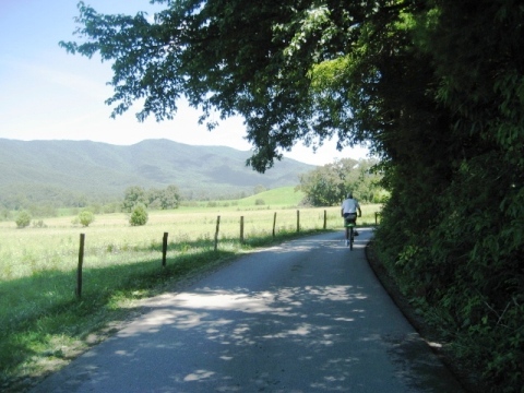
Cades Cove
Cades Cove in the northwest portion of the Park in Tennessee is one of the most popular destinations in Great Smoky Mountains National Park. Traffic jams are common as people stop to admire the scenery and watch the wildlife, including black bear and deer.
- The 11-mile, paved Cades Cove Loop Road is
our favorite bike ride in the Great Smokies,
with many historic structures, hiking, a waterfall and abundant
wildlife. Biking is best from May to
September when the road is closed to motor
vehicles
all day on Wednesdays. Here's a
direct link to confirm car-free days and closures:
> See our FULL CADES COVE BIKING REPORT with 55+ PHOTOS here
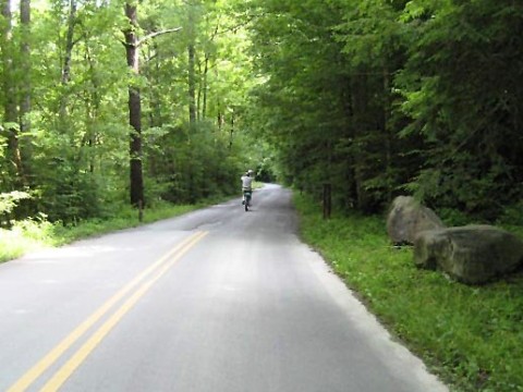
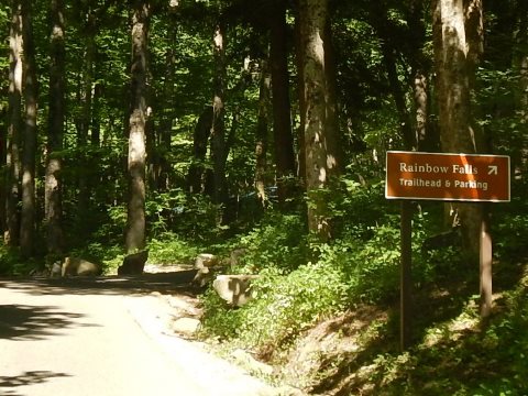
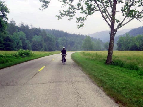
Tremont
The Tremont area in Tennessee, along the Middle Prong Little River is a popular area for fishing and hiking, and is one of the most scenic areas in the Smokies. Today it's home to the Great Smoky Mountains Institute at Tremont. (an outdoors and wildlife learning center).
- Biking is along Upper Tremont Road which leads to a trailhead to several hiking trails
Roaring Fork Motor Nature Trail
The Roaring Fork Motor Nature Trail is a narrow and winding, one-way road following Roaring Fork, a fast-moving mountain stream. Starting in Gatlinburg, Tennessee, the first 2.5 miles is two-way traffic, and the last 5.5 miles is one-way.
- One of the most popular drives in the Smokies, the road is bikeable. The route features historic buildings, old grist mills, streams, waterfalls, trails, old-growth forest, and mountain views.
> See our FULL ROARING FORK BIKING REPORT with 20+ PHOTOS here
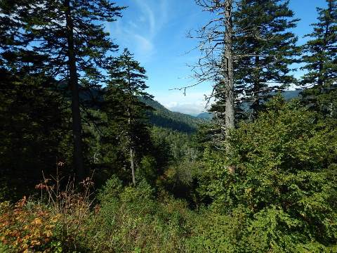
Cataloochee Valley
Cataloochee consists of three valleys in the southeast in the southeast area of the Park in North Carolina, a remote area in the Balsam Mountains. Historical structures, wildlife and elk viewing, hiking, camping.
- The valley is relatively flat for easy biking, though the road into the valley is narrow and twisty with no guard rails.
> See our FULL CATALOOCHEE VALLEY BIKING REPORT with 20+ PHOTOS here
Hiking at Great Smoky Mountains National Park
Hiking at Great Smoky Mountains National Park includes 800 miles of trails ranging from easy family-friendly hikes to multi-day backcountry adventures, plus 70 miles of the Appalachian Trail runs through the park. Scenic vistas, cascading waterfalls, old-growth forest, historic settlements, and wildlife are some of many sights. Here are some popular (and easy) destinations we visited.
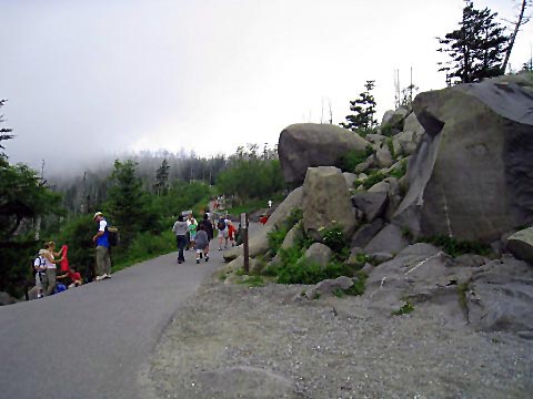
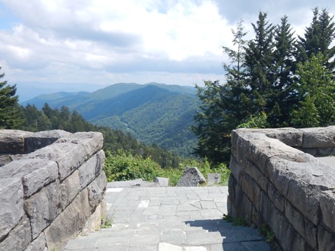
Kuwohi (Clingmans Dome)
Kuwohi (formerly known as Clingmans Dome), is the highest peak in Great Smoky Mountains National Park at 6,643 feet, and another popular destination in the National Park.
- A 1/2 mile paved, steep trail leads to an observation tower with a 360-degree view of the surrounding area.
Newfound Gap - Appalachian Trail
Newfound Gap is the lowest drivable gap through Great Smoky Mountains National Park. The popular Overlook, with parking, restrooms and stunning views, straddles the State Line between Tennessee and North Carolina.
- The parking area serves as a trailhead for the Appalachian Trail.
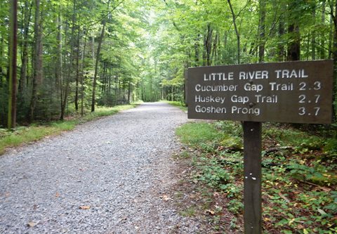
Elkmont - Little River Trail
Elkmont was an early settlement, a logging town, and later a resort community in the upper Little River Valley in Tennessee before creation of Great Smoky Mountains National Park. Today, it consists of the Daisy Town Historic District (a Ghost Town with buildings from the old resort community), a large campground, and access to some excellent hiking trails.
- The Little River Trail runs on an old logging railroad bed along the Little River, passing old homesites, and linking to several other trails and backcountry campsites.
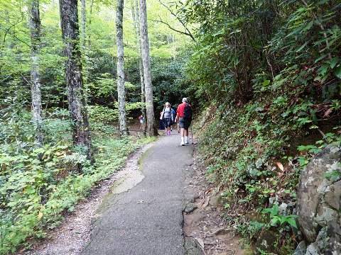
Laurel Falls
Laurel Falls is a lovely 80-foot waterfall. A popular destination, it's reached via the Laurel Falls Trail - 2.6 miles round-trip.
- The Laurel Falls Trail offers mountain views and is very scenic. Paved and easy to hike, it's one of the most visited trails in the National Park.
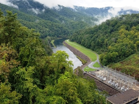
Fontana Dam
Historic dam provides hydroelectric power and flood control in the Tennessee River Valley. The dam forms Fontana Lake with numerous recreational opportunities. Visitor Center with parking, restrooms, information.
- The Appalachian Trail crosses the dam with scenic views as it enters the National Park.
More Information and Resources
Nearby Biking:
Townsend Historical Trail (Tennessee)
Related Resources:
National Park Service - Great Smoky Mountains
National Park
-
Biking in Great Smoky Mountains National Park
-
Hiking in Great Smoky Mountains National Park
Support and Advocacy:
Friends of the Smokies

Copyright © BikeTripper.net. All Rights Reserved. Have Bikes - Will Travel