Bike Tripper
Have Bikes, Will Travel
Bike Trail Maps & Photos Galore
You are here > Home >
Great Smokies >
Kuwohi
Latest update: September 2024
Kuwohi (formerly Clingmans Dome)...
The Highest Peak in the Smokies...
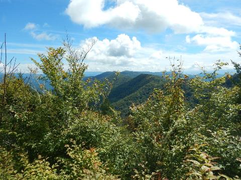
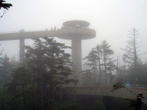
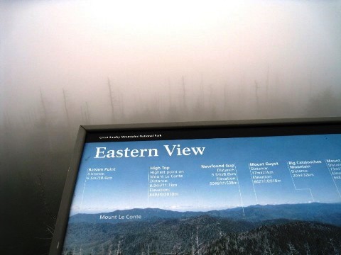
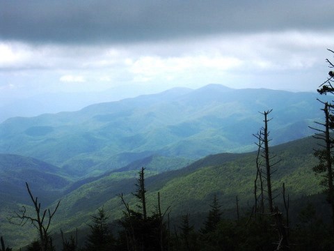
Kuwohi is the highest peak in Great Smoky Mountains National Park and in Tennessee at 6,643 feet. Formerly called Clingmans Dome, the original Cherokee name has been restored. This is one of the most popular destinations in the Smokies, with a trail leading to an observation tower with a 360-degree view of the surrounding area - on clear days, up to 100 miles. The mountain itself lies on the border between North Carolina and Tennessee. A section of the Appalachian Trail also crosses here. (Detailed map and photos below.)
Location: Great Smoky Mountains National Park,
North Carolina and Tennessee (See map)
Distance: 1 mile round-trip to observation tower
Surface: Paved
Trailheads/Parking: Trailhead parking (parking
tag  is required when parking longer than 15 minutes at the trailhead).
Shuttles are available when parking is full.
is required when parking longer than 15 minutes at the trailhead).
Shuttles are available when parking is full.
Page Summary:
- Kuwohi
- Kuwohi Trail
- Trail to Observation Tower
- More views - Some History
- More Information and Resources
Kuwohi... Comments and Photos
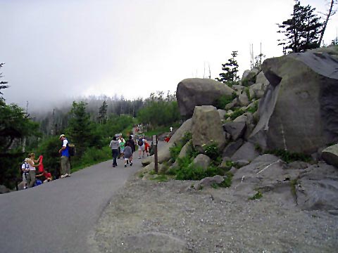
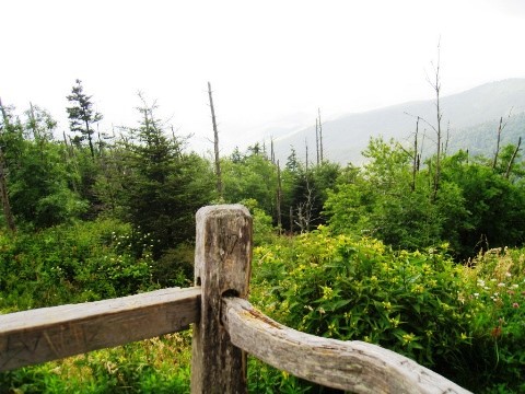
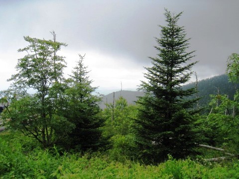
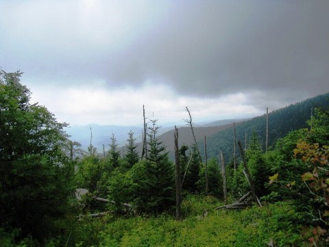
The 7-mile access road to Kuwohi is a scenic ride, but due to its popularity traffic can be heavy and the parking lot can get full with long waits to find a spot. It can be cloudy and rainy, with cold temperatures (even in summer) at the higher altitude, so bringing a jacket is a good idea. On our visit, we experienced both clouds and chilly temperatures. On a later visit, the sky was clear but the road was closed due to searching for a lost hiker - we hope eventually to get to the Observation Tower on a clear day.
- Note: while the trail is open year-round, the 7-mile Kuwohi Road is closed from November to April, so getting there in winter is via hiking or cross-country skiing.
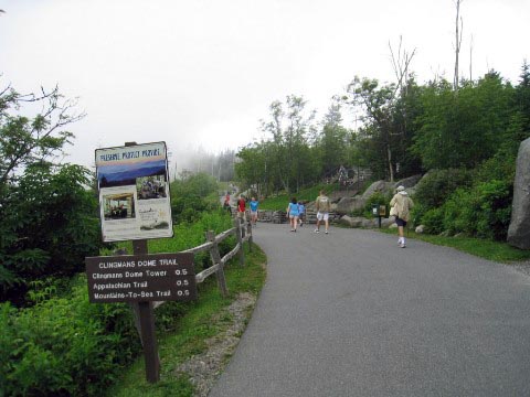
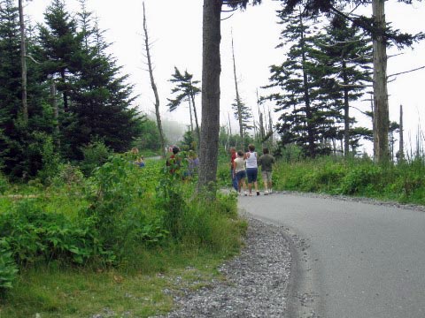
Kuwohi Trail
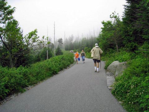
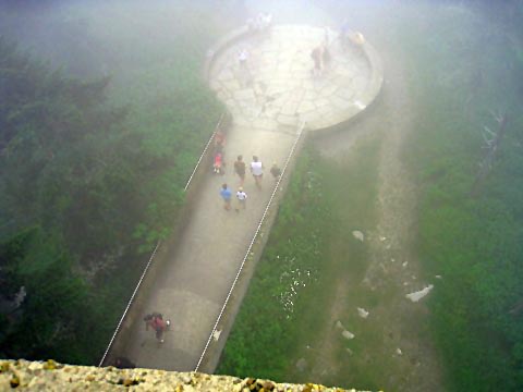
The half-mile trail to the Observation Tower starts at the parking area. The pathway is paved but steep (332 feet gain, with a 13% grade).
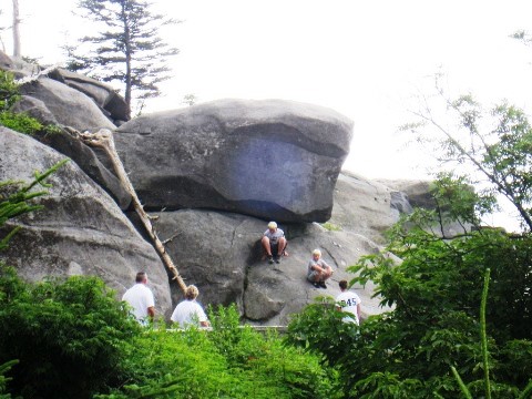
- The hike is rated moderate to strenuous, depending on your fitness level. Benches are provided along the way to rest. We took our time going up, also feeling the effects of the altitude on our breathing.
- A 375-foot spiral ramp leads to the observation platform. The day we visited being cloudy, the views at the top were unfortunately hidden, but we did enjoy some better views at lower altitudes.

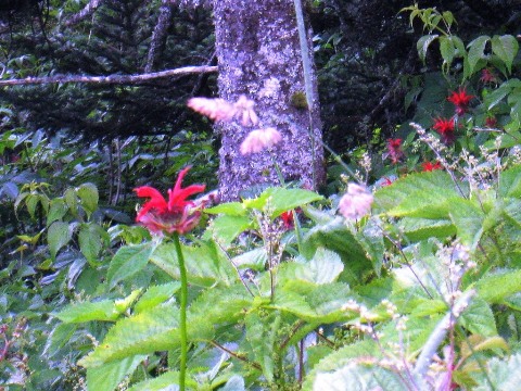
A Colorful Array


Some History
- The Cherokee name Kuwohi means "the mulberry place." This was sacred to the Cherokee, a place for spiritual guidance. Early European settlers dubbed it Smoky Dome, then the name Clingmans Dome (for Thomas Clingman, a lawyer, Confederate General, US Representative and Senator who explored in the area), was adopted in 1859. In 2022, the Eastern Band of Cherokee petitioned to have the name reverted to its original, and in September 2024 the change was officially recorded.
- Kuwohi is the highest mountain in the National Park, the highest point both in Tennessee and along the Appalachian Trail, and the third highest mountain east of the Mississippi River.
- The Observation Tower, built in 1959, is listed on the National Register of Historic Places.
More Information and Resources
Nearby Biking and Hiking:
Great Smoky Mountains (Overview)
Related Resources:
National Park Service - Great Smoky Mountains
National Park
-
Hike to Kuwohi (Clingmans Dome)
Support and Advocacy:
Friends of the Smokies

Copyright © BikeTripper.net. All Rights Reserved. Have Bikes - Will Travel