Bike Tripper
Have Bikes, Will Travel
Bike Trail Maps & Photos Galore
You are here > Home >
Great Smokies >
Tremont
Latest update: August 2024
Tremont...
Biking and Hiking in Great Smoky Mountains National Park
Tremont (its name a combination of "tree" and "mountain") was site of an early settlement in the mid-1800's that evolved into a logging town for the Little River Lumber Company until it was dissolved after creation of Great Smoky Mountains National Park in the 1930's. Today, the area is home to the Great Smoky Mountains Institute at Tremont. Popular activities include hiking, biking, and fishing. (Detailed map and photos below.)
Location: Great Smoky Mountains National Park,
Tennessee (See map)
Distance: 3-mile road, many miles of hiking trails
Surface: Paved and gravel
Trailheads/Parking: Smoky Mountains
Institute, end of Upper Tremont Rd.(parking tag required)
Bike Shops/Rentals: N/A
Page Summary:
- Biking and Hiking at Tremont
- Tremont Institute and Upper Tremont Road
- Hiking
- Middle Prong Trail
- Thunderhead Prong Trail - More Information and Resources
Biking and Hiking at Tremont... Comments and Photos
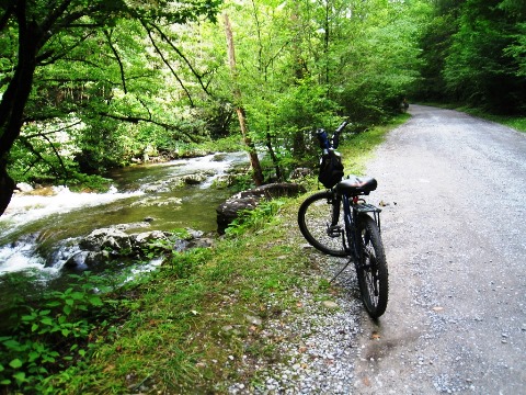
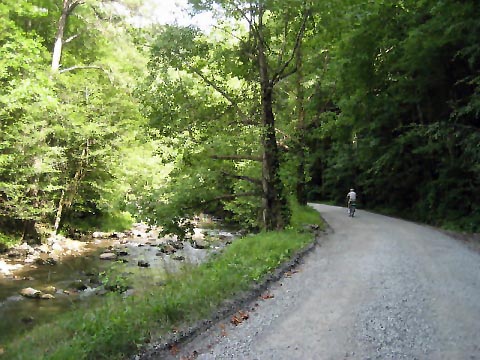
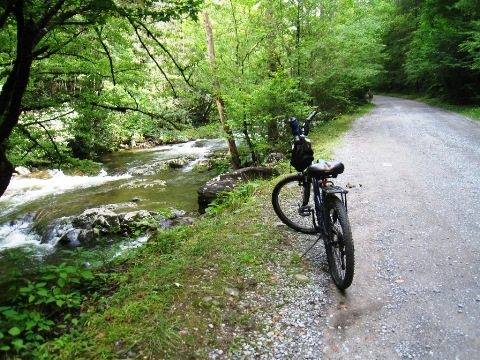
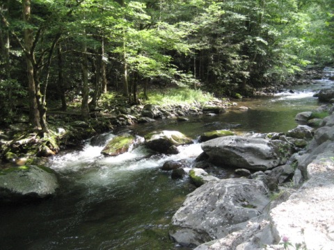
Upper Tremont Road along the Middle Prong Little River is a popular area for fishing and hiking, but it's also an excellent bike ride through one of the most scenic areas in the Smokies. At the end of the road, a bridge crosses the river to Scenic hiking trails.
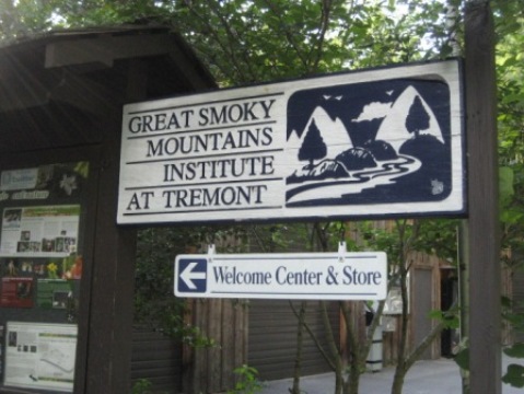
Tremont Institute and Upper Tremont Road
Tremont Institute is an outdoors
and wildlife learning center offering student-centered educational
programs including summer camps, school programs, family camps,
and naturalist workshops.
More information

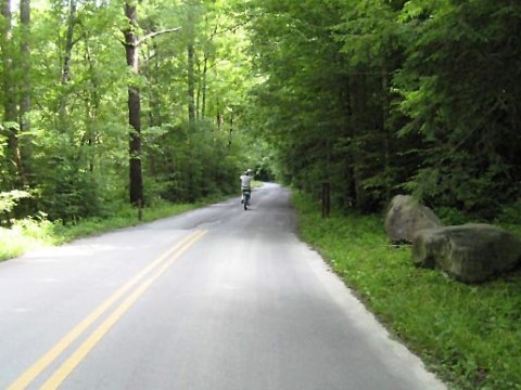
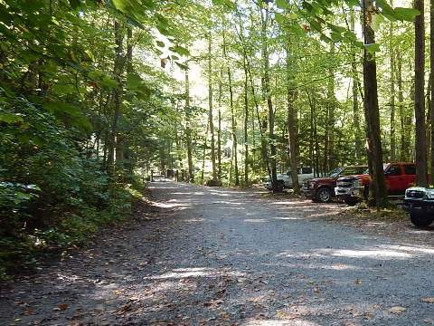
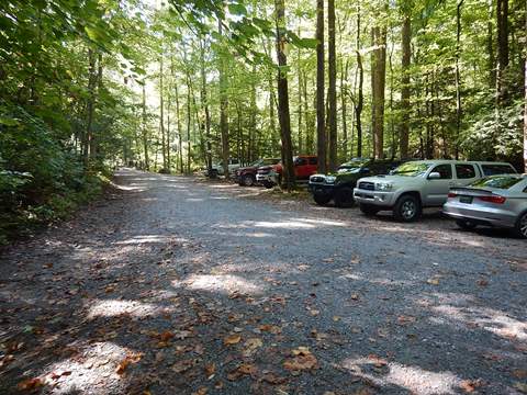
- Upper Tremont Road past the Institute goes up the mountain along the Middle Prong Little River, a scenic ride.
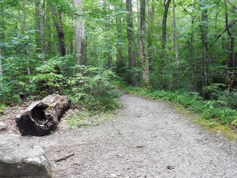
- The pavement ends past the Institute and the roadbed becomes well-maintained gravel. The 3-mile ride gets steeper at the top - we did walk part of the way. The ride back down was easy, though!
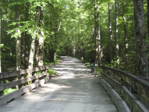
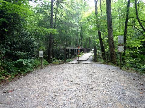
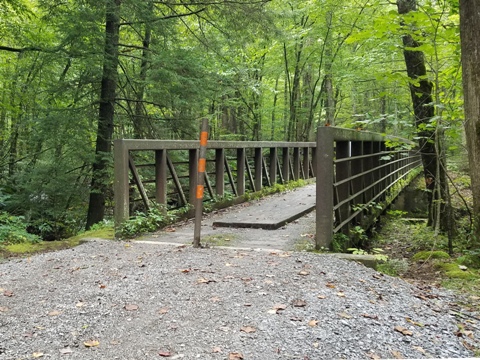
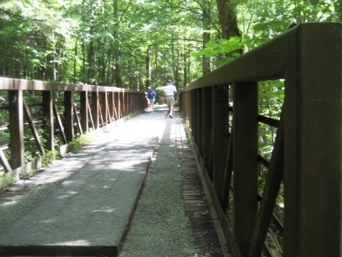
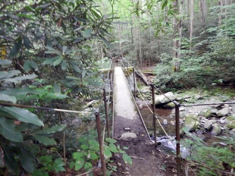
- Trailhead parking is located at the end of the road. This ends the bike route, across the bridge is hiking only.
Hiking
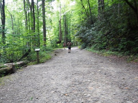
Trailhead
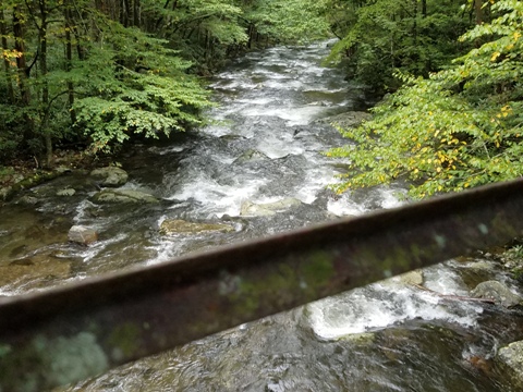
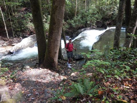
Past the trailhead (parking only), the bridge is at the juncture of Lynn Camp Prong and Thunderhead Prong, which join to form the Middle Prong Little River. The Middle Prong Trail and Thunderhead Prong Trail start across the bridge.
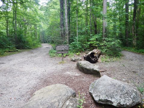
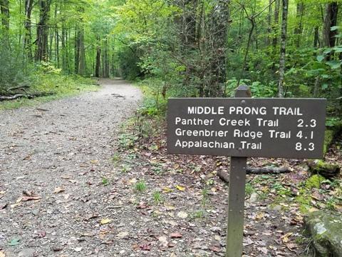
Middle Prong Trail
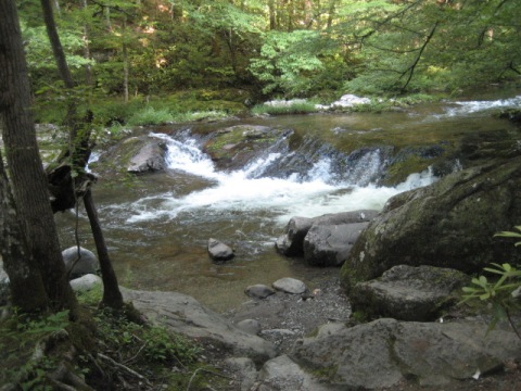
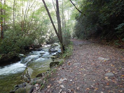
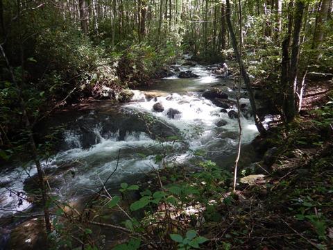
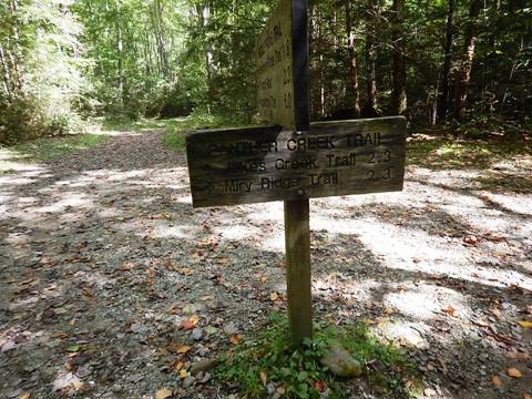
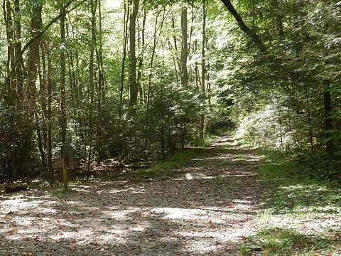
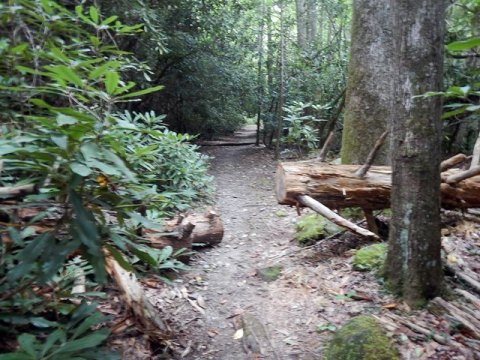
Signs mark the Middle Prong Trail, take the left fork past the bridge. The hike (8.3 miles round-trip to Indian Flats Falls), is well worth it, with scenic waterfalls and cascades. The trail runs on an old Little River Lumber Company railroad grade dating from the early 1900's, following the Lynn Camp Prong. We hiked the first 2.3 miles to the Panther Creek Trail. Note: The trail has a "strenuous" rating due to its length and altitude gain (1,140 feet), but we had no difficulty on the section we hiked.
Features along the trail:
- Waterfalls: Lower Lynn Camp Falls, Lynn Camp Falls, Indian Flats Falls
- Trails: Panther Creek Trail, Thunderhead Prong Trail
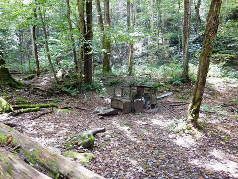
- A 1920's-30's rusting Cadillac, remnant from a CCC camp here.
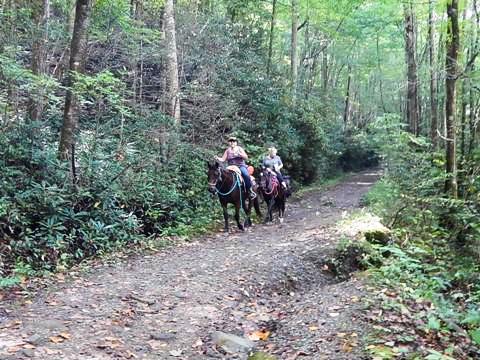
- Equestrians are allowed.
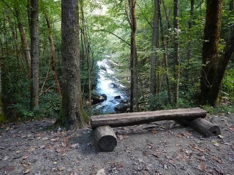
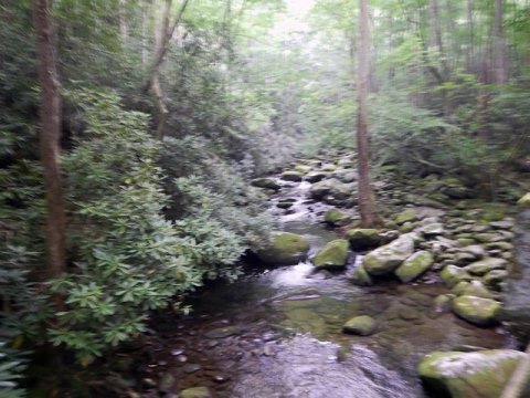
Lynn Camp Prong from the bridge (40 sec. video)
Along the Middle Prong Trail (30 sec. video)
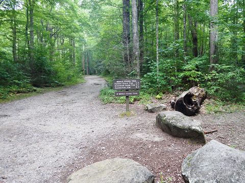
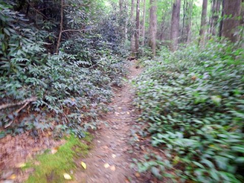
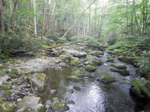
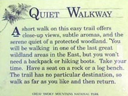
Thunderhead Prong Quiet Walkway
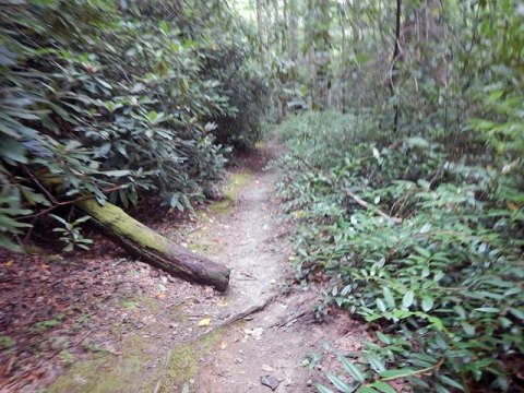
There are no signs marking this trail - at the sign pointing left to Middle Prong Trail, go to the right instead. Thunderhead Prong Quiet Walkway (1.3 mile round-trip) is a short but scenic hike along Thunderhead Prong. The trail can be narrow with some roots, but easy to hike. There were some downed trees that had been cut to clear the path. We went a short way to the I-Beam bridge that gave a good view crossing the creek.
- The "Quiet Walkways" of the Smokies are shorter, easy trails off the main routes that give quick views of the surrounding woodlands.
More Information and Resources
Nearby Biking:
Great Smoky Mountains (Overview)
Townsend Historical Trail
Related Resources:
National Park Service - Great Smoky Mountains
National Park
Support and Advocacy:
Friends of the Smokies

Copyright © BikeTripper.net. All Rights Reserved. Have Bikes - Will Travel