Bike Tripper
Have Bikes, Will Travel
Bike Trail Maps & Photos Galore
You are here >
Home >
New York >
Erie Canalway Trail >
West Region
Latest update: June 2025
Erie Canalway Trail... West
Biking and Touring from Rochester to Buffalo
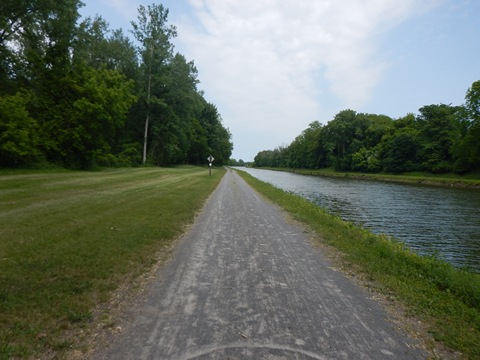
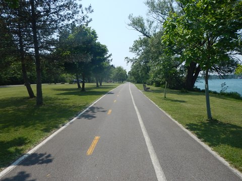
This section of the Erie Canalway Trail runs 95 miles from Rochester to Buffalo. The trail between Rochester and Lockport is mostly stonedust; from Lockport to Buffalo is mostly paved off-road, with a few sections on-road.
- The historic canal towns along the way are pleasant stops with quaint downtowns, parks, food, accommodations, and historic canal structures. We enjoyed visiting several of these charming canal towns, viewing portions of trail along the way. In Buffalo, we visited the very end (or start) of the Empire State Trail at Buffalo Harbor State Park.
3 Suggested Rides
- Lockport
- Tonawanda.
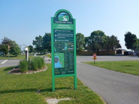
- Shoreline Trail in Buffalo
(Detailed map and photos below.)

Location: Rochester to Buffalo, NY (See map)
Distance: 95 miles
Surface: Various - paved asphalt, compacted
stonedust, on-road
Bike Shops/Rentals:
View full list of bike shops 
Page Summary:
Erie Canalway Trail -
Rochester to Buffalo - 95 miles
- Rochester to Lockport
- Village of Holley
- Village of Medina - Lockport to Tonawanda
a. Lockport to Pendleton
**A Suggested Ride
- Lockport Locks, Discovery Center
- East Lockport to Lockport Locks
- Lockport Locks to Pendleton
b. Amherst to Tonawanda
- Buffalo Niagara Heritage Center
- Ellicott Creek Park
c. Tonawanda
- Ellicott Creek Park to Gateway Harbor Park
**A Suggested Ride
- Shoreline Trail - Buffalo
**A Suggested Ride
- Buffalo Harbor State Park
- Shoreline Trail - Industrial Heritage Trail
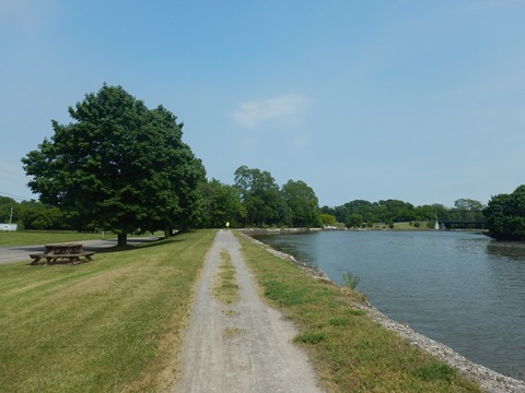
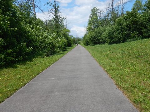
Rochester to Lockport (miles 269-330)
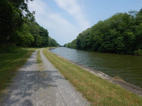
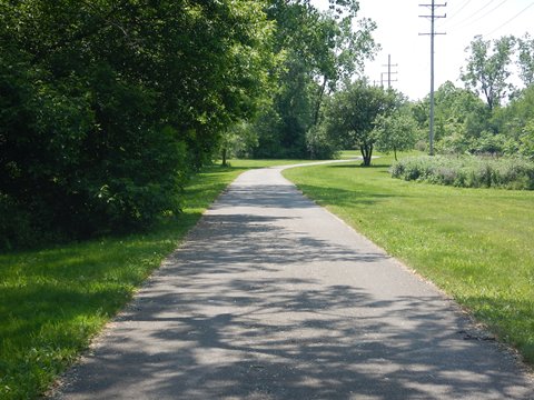
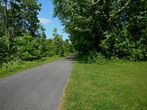
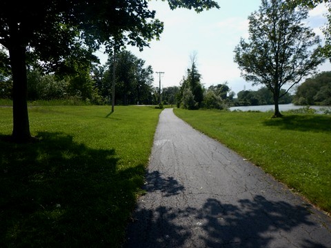
Passing through Rochester is more urban with nearby commercial areas, neighborhoods, parks, and the University of Rochester, but the trail along the canal is well buffered and scenic. Past Rochester is more serene, running on stonedust past farmlands and wooded areas between towns. The old canal towns have a lot of history - we enjoyed visiting, plus viewing and biking sections of the trail.
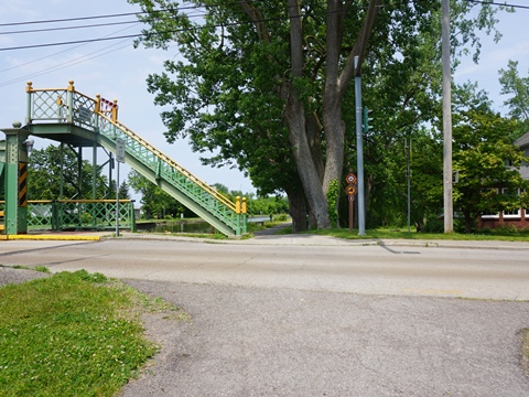
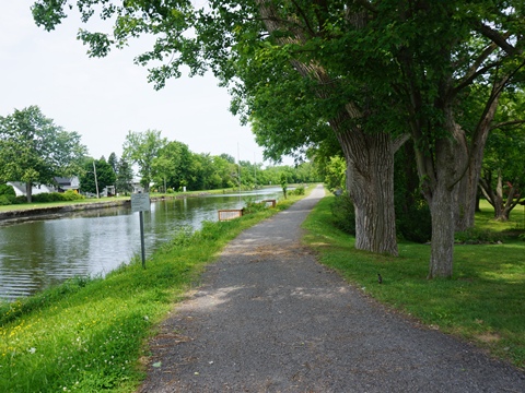
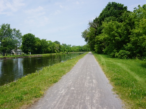
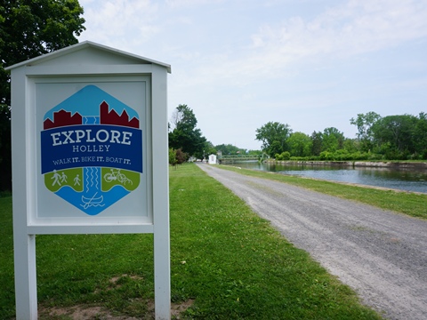
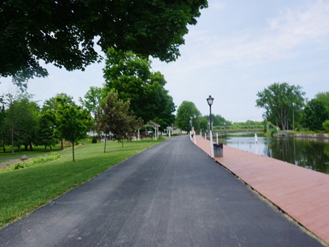
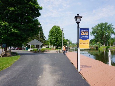
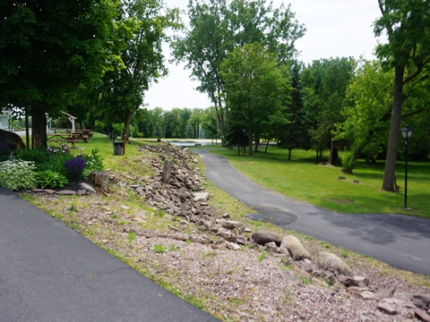
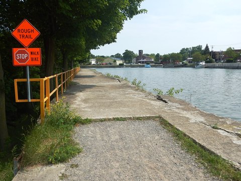
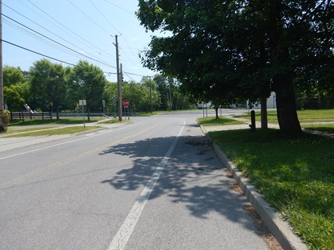
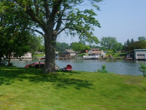
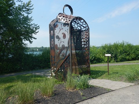
Village of Holley (mile 292)
Trail at Holley
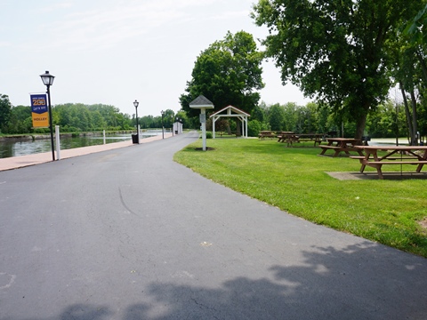
Holley is a small village with a lot of canal history. Its historic Village Square and business district offer amenities including food, shops, and B&B accommodations. The Canalway Trail on the north side of the canal is stonedust, easy to ride.
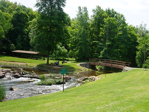
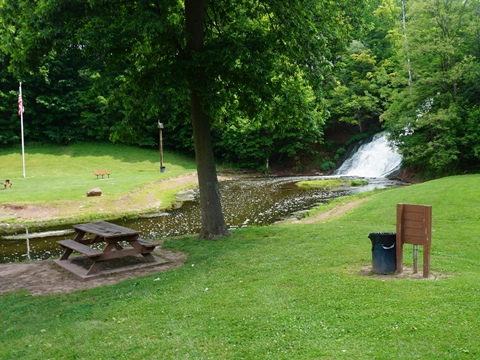
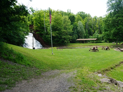
Canal Park
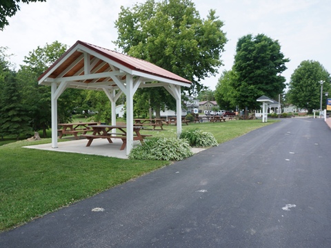
From the Canalway Trail, cross the East Avenue Lift Bridge to Canal Park, with parking, restrooms, gazebo, playground, and boat dock. A portion of the Old Erie Canal Trail runs along the canal, with nature trails to Holley Falls and the Village Square.
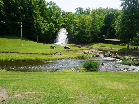
Holley Falls
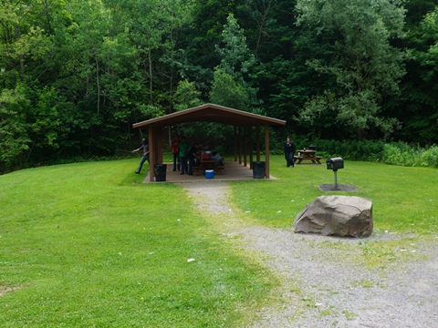
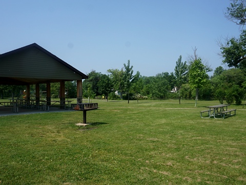
Holley Falls lies to the east of Canal Park. The 35-foot waterfall is manmade, built to collect overflow from the Erie Canal. The scenic site includes picnic tables and pavilion, footbridge, and a network of nature trails including pathways right up to the falls.
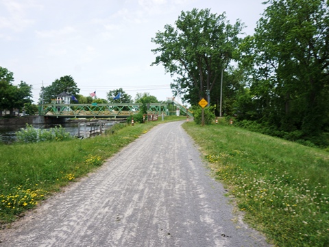
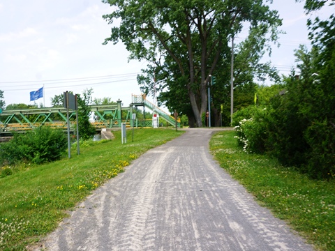
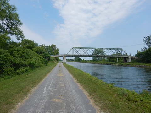
Village of Medina (mile 312)
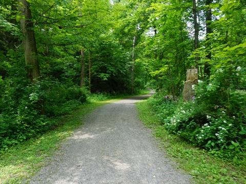
We biked a 4-mile section of the Canalway from the Medina Lift Bridge, past Medina Falls, to the Beals Rd. bridge. Except for a short section past the falls, the trail is smooth, crushed stone suitable for recreational bikers such as us. We found it easy to ride on our fat-wheel bikes. The trail runs canalside, under several bridges where roads cross.
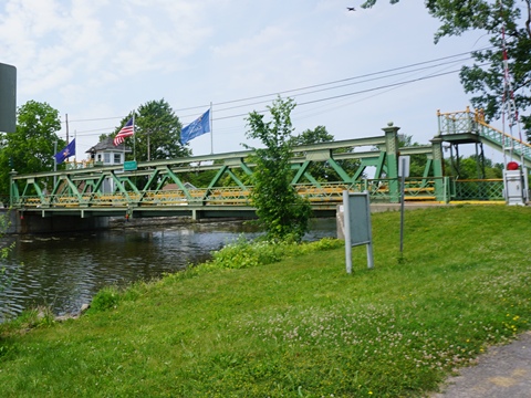
Medina Lift Bridge to Medina Falls
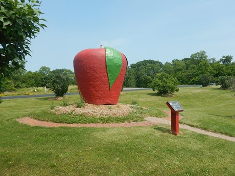
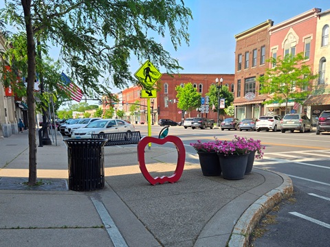
Parking and picnic tables are along the trail next to the Medina Lift Bridge. The trail runs across the canal from Medina's main business center with views of the waterfront. It passes Lions Park with its Big Apple sculpture, a tribute to area fruit growers. Approaching the Falls, the surface becomes rough concrete, signs suggest walking and we agree.
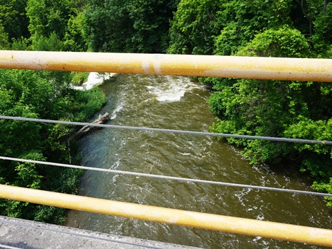
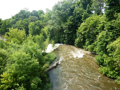
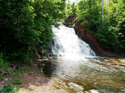
Medina Falls (10 sec. video)
The viewpoint for Medina Falls is along the canalway trail near the Horan Rd. parking area. This a 40-foot, natural waterfall along Oak Orchard Creek. It's unique because the creek runs under the Erie Canal before going over the falls - an aqueduct was constructed to carry the canal over the creek.
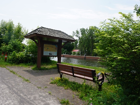
Medina Falls to Conservation Club
Just past the falls near the Horan Rd. bridge is a parking area with benches and information kiosk. Briefly paved here then continuing eastbound, the trail again is crushed stone. At Bates Rd. it branches off to run past the Medina Conservation Club. It crosses Bates Rd., then links back to the canal. This a less-developed area, passing woodlands and fields.
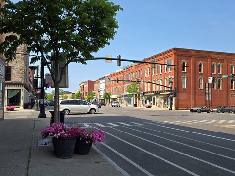
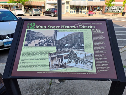
Main Street Historic District
The Main Street Historic District is picture-postcard scenic, with 52 historic structures built with Medina's iconic sandstone, a material key to Medina's industrial past. It's listed on the National Register of Historic Places. Running south from the canal, the district is very walkable, featuring a variety of shops, restaurants, churches and other businesses, plus the Medina Railroad Museum and the Medina Sandstone Hall of Fame.
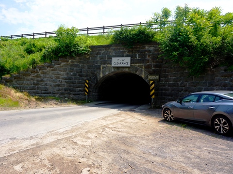
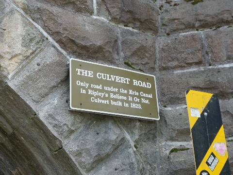
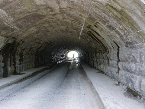
Culvert Road Tunnel
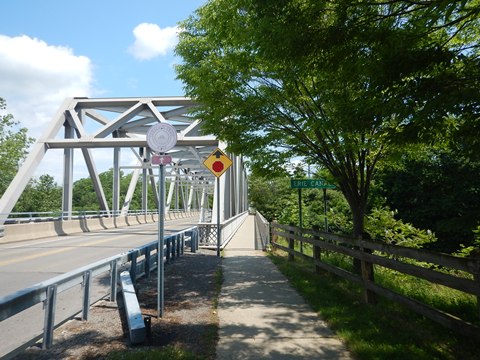
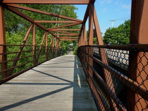
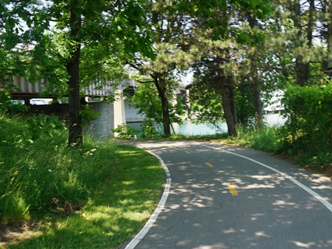
About 3 miles east of Medina, the Culvert Road Tunnel is worth the short trip - it's the only place you can go under the Erie Canal. Built in 1823 (later modified when the canal was widened), the lay of the land made it possible to design this cheaper option to building a bridge over the canal. The tunnel is one lane with sidewalks on either side to allow walking through - parking areas are provided outside. Paths lead up to the Canalway Trail, which crosses over.
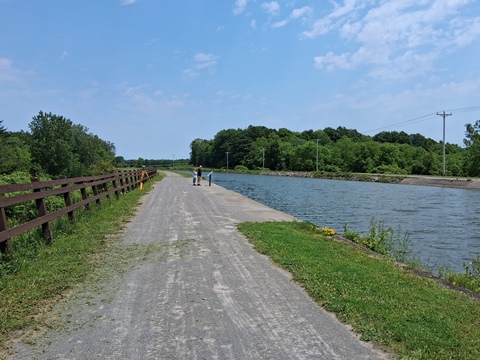
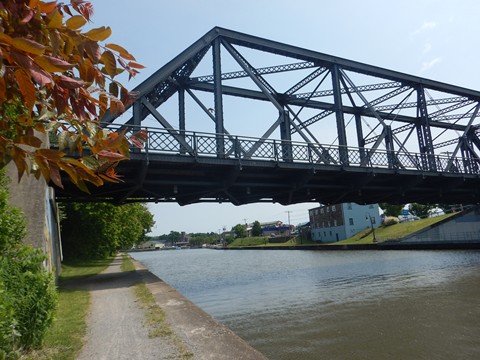
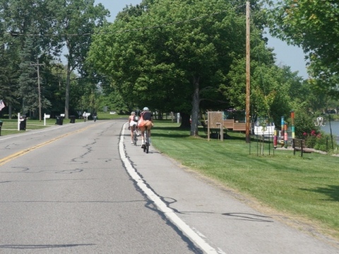
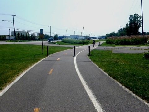
Lockport to Tonawanda (mile 330-348)
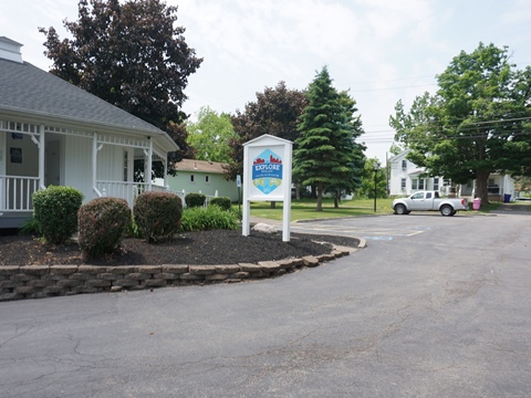
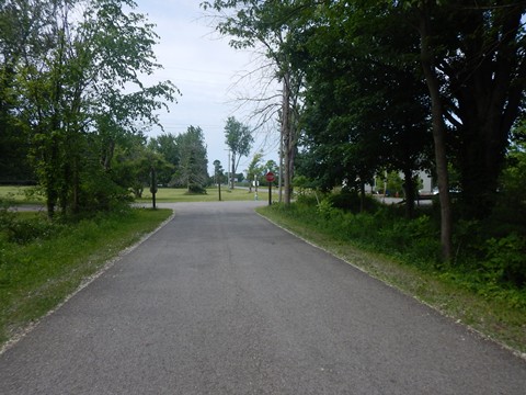
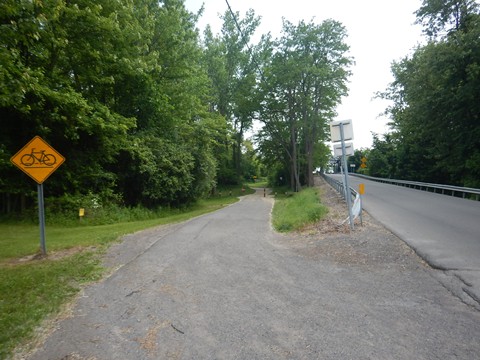
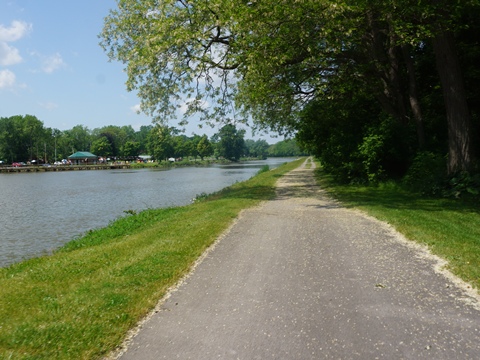
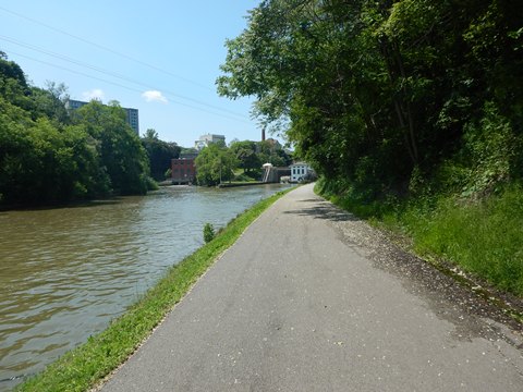
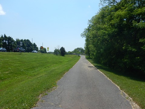
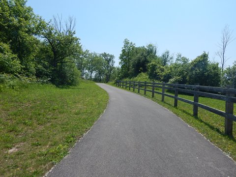
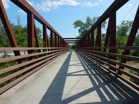
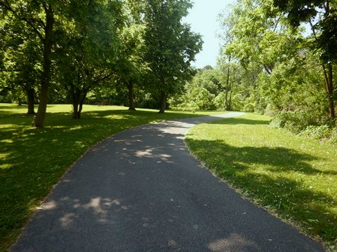
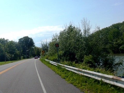
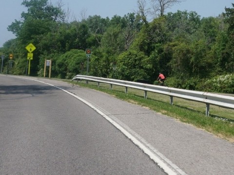
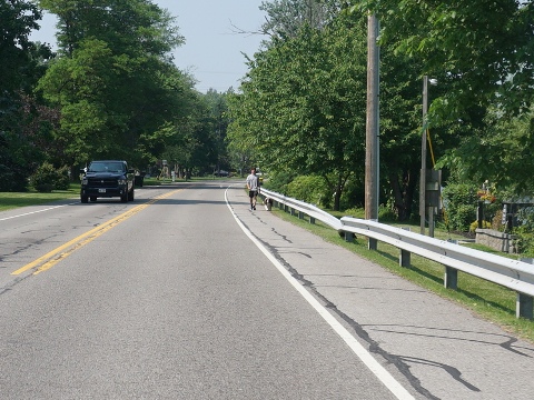
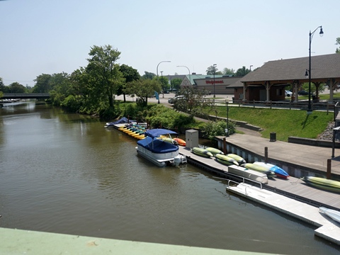
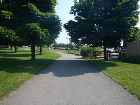
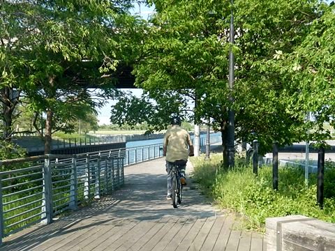
We enjoyed visiting Lockport and Tonawanda, iconic canal towns bursting with history (more details below). A bonus is the Erie Canalway Trail between the towns - ideal for casual recreational bikers. We highlight this as a Suggested Ride (or several shorter rides, as we did). The trail is paved - mostly off-road, with a few sections running roadside through rural and suburban areas. Trailheads are located in Lockport, Pendleton, Amherst, and Tonawanda, with food, accommodations and shops nearby.
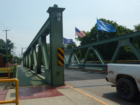
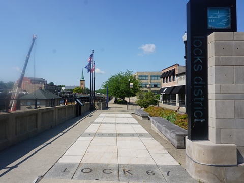
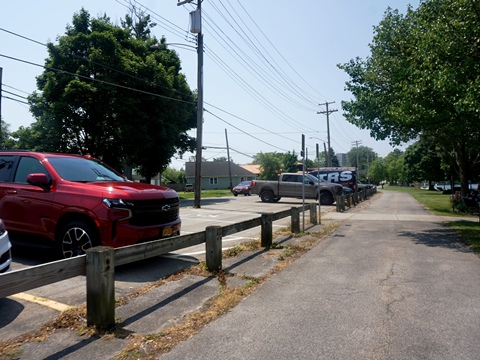
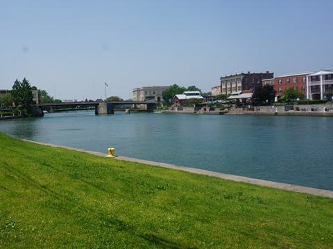
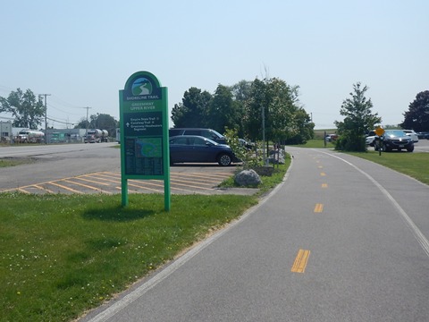
Lockport (mile 330)
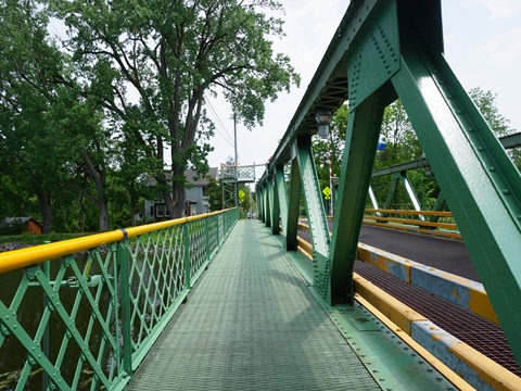
Lockport is a highlight with a lot of canal history. We visited the Lockport Locks Heritage District, then explored locations along the Canalway Trail from Lockport to Tonawanda.
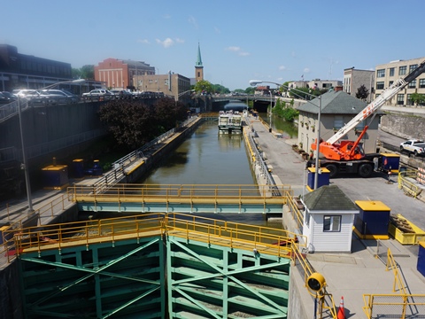
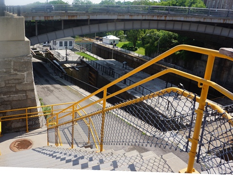
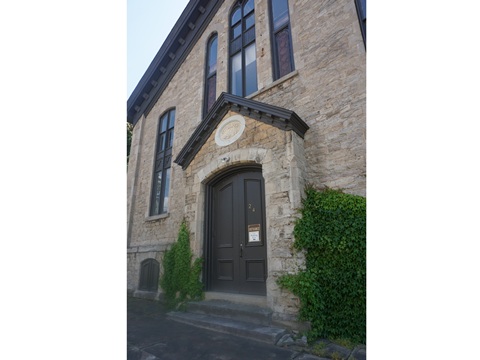
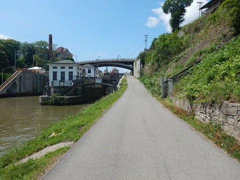
The Lockport Locks Heritage District
The Lockport Locks Heritage District includes
museums and interpretative signage, viewing platforms, restaurants
and shops, canal boat tours, and Lockport Cave tours. We visited the
Erie Canal Discovery Center and viewed the Locks from
bridges and viewing platforms along restored Canal Street.
(pedestrian and bicycles-only).
More information .
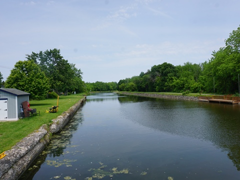
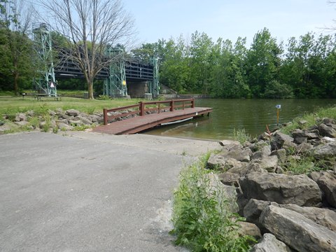
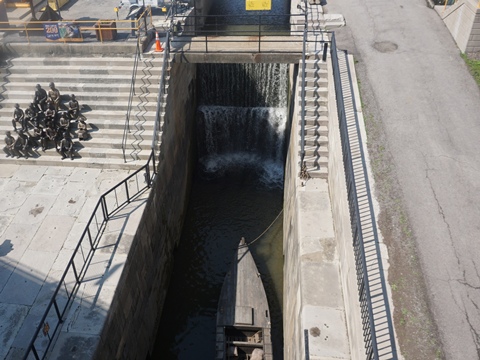
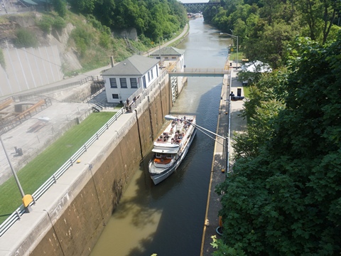
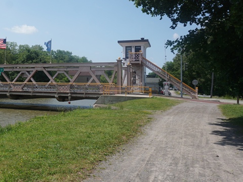
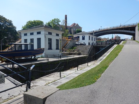
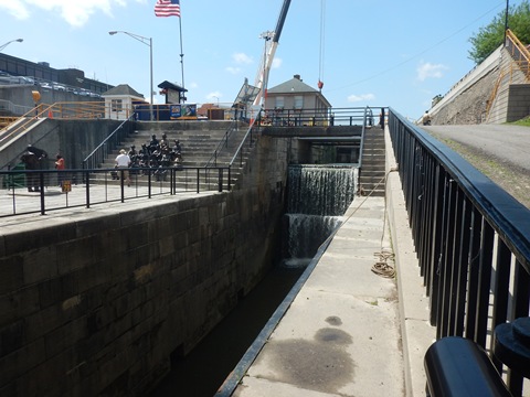
Lockport Locks
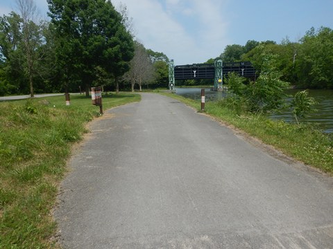
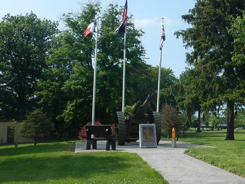
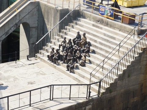
- The historic “Flight of Five” (Locks 67-71) is a key feature. Considered a marvel of 19th-century canal engineering, the five-step staircase was designed to raise and lower canal boats 60 feet over the Niagara Escarpment (ridge). Originally built in 1825, three have been restored as demonstration exhibits. The adjacent updated Locks 34 and 35 are used for today's navigation. The Lock Tenders Tribute Monument and the Locks District Museum are on site.
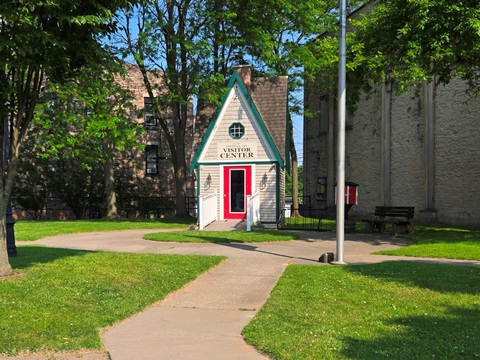
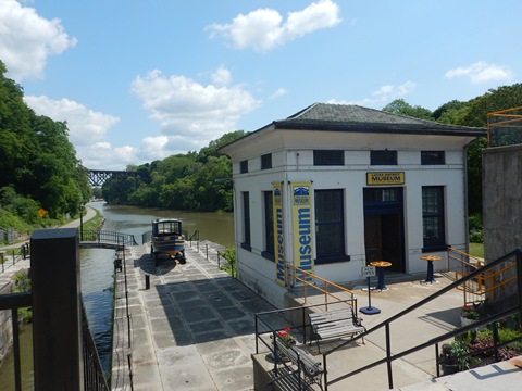
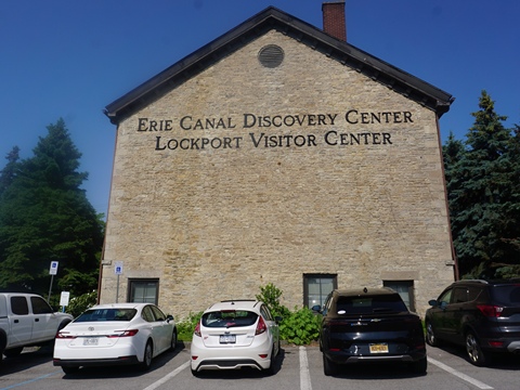
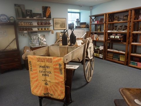
- The Erie Canal Discovery Center is inside an 1840's canal stone building (made with stones dug up when the canal was built). Displays and artifacts, interactive exhibits, “Gateways East & West” film, and a virtual canal boat ride. Parking, restrooms, gift shop. Admission fee applies.
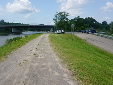
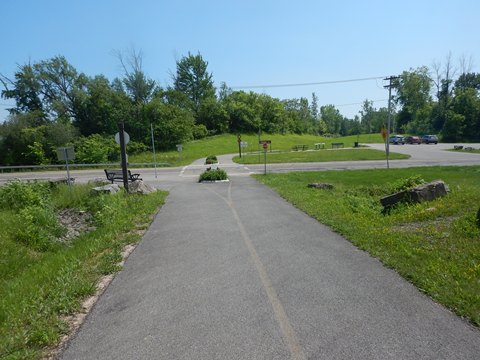
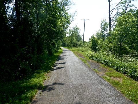
Lockport to Pendleton (7 miles)
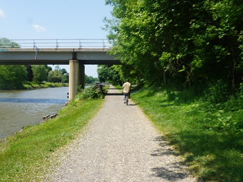
*A Suggested Ride* This section runs through Lockport, past the Lockport Locks, to the Feigle Rd. trail access in Pendleton. We enjoyed the ride through diverse surroundings with a lot of history.
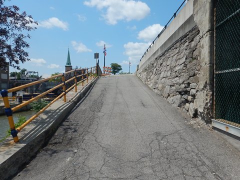
- We start at the N. Canal Rd. parking area in east Lockport. The trail runs along the canal, unpaved but easy to ride. It becomes paved in town, continuing paved westbound.
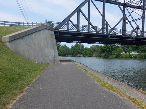
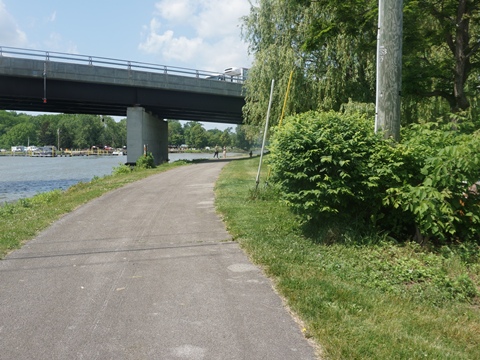
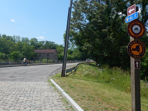
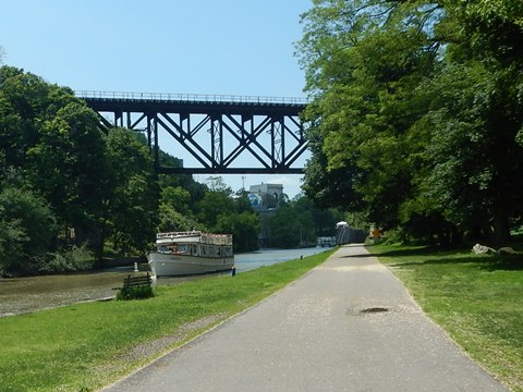
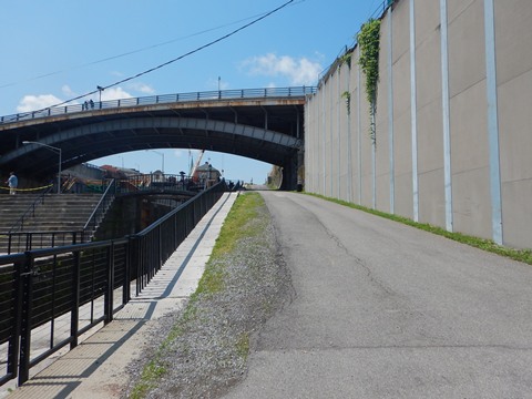
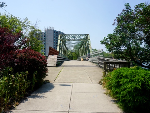
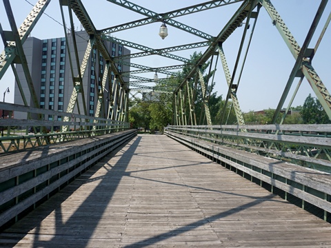
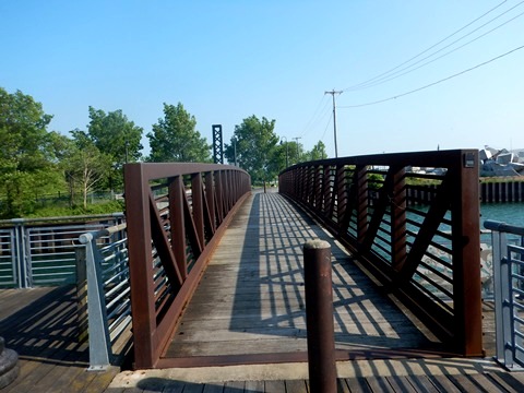
From the parking area, the trail passes or runs under several bridges. Past the Mill St bridge, it runs on the roadway for a block then loops around a maintenance facility. Approaching the locks district, it runs under the "Upside-Down Bridge" (a deck-truss railroad bridge, 1902).
From the locks, the Canalway Trail runs roadside along local roads to Stephens St. It crosses a bridge over the canal and continues alongside State Rd. to a parking area. It then runs off the road for about a mile, until re-emerging alongside State Rd. near the Lockport Bypass.
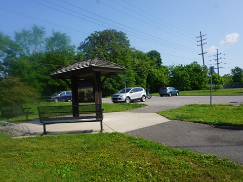
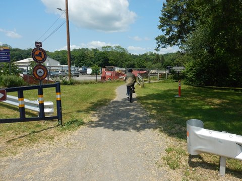
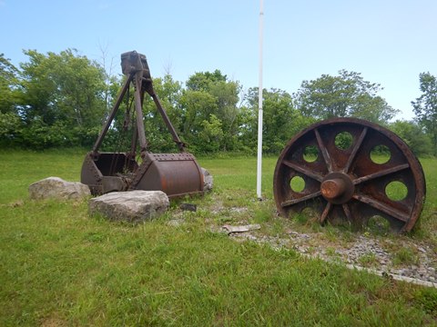
After crossing the Bypass road, the surroundings become more rural - a tranquil, pleasant ride. Trail access points are at Robinson Rd. (parking, benches), and at Feigle Rd. in Pendleton (parking, picnic, and an interesting display of historical artifacts related to canal operations).
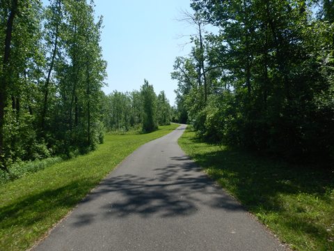
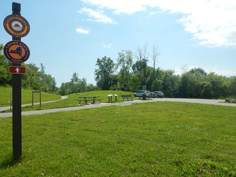
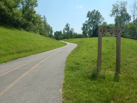
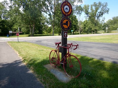
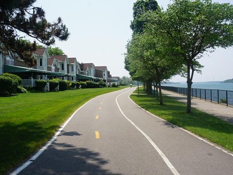
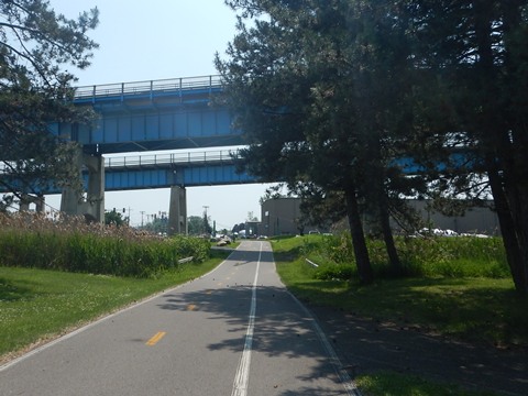
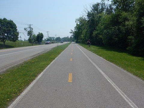
Amherst to Tonawanda (9 miles)
Town of Amherst (mile 343)
Amherst was founded in 1818, and grew with opening of the Erie Canal. Historical markers and interpretive signs tell its canal past, with some old abandoned locks and original canal beds still visible.
- The trail enters Amherst across a bridge over Tonawanda Creek, then continues paralleling the creek through part of the town.
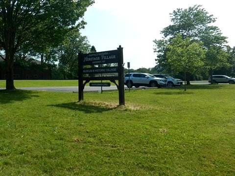
- Shortly past the bridge a connector runs to Buffalo Niagara Heritage Village.
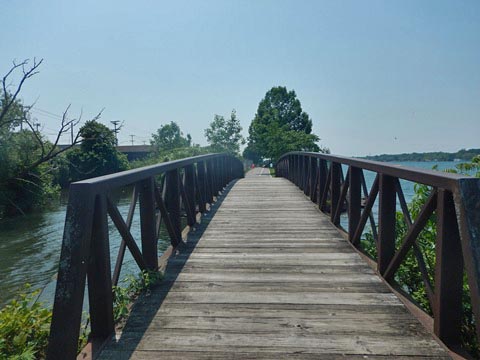
Crossing Tonawanda Creek into Amherst
Buffalo Niagara Heritage Village to Ellicott Creek Park
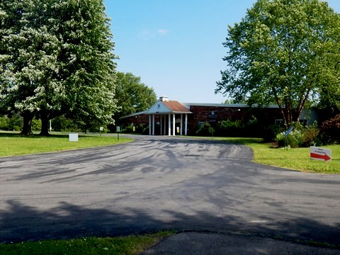
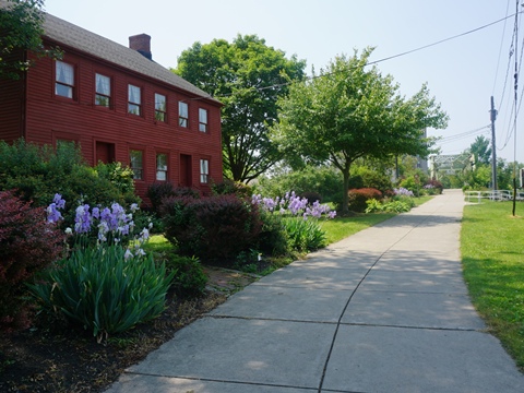
Buffalo Niagara Heritage Village
Buffalo Niagara Heritage Village is an open-air museum demonstrating 19th century life with 10 historic buildings, interactive activities, exhibit hall and research library. Parking and picnic tables available, and restrooms open during museum hours.
The buildings were moved from town, saved
from demolition due to development.
More information .
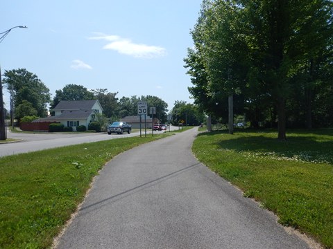
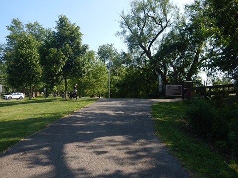
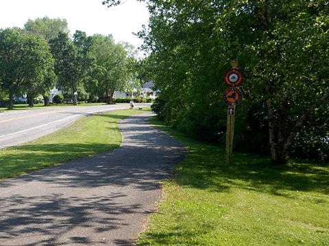
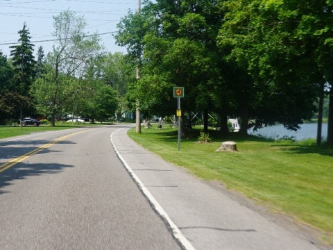
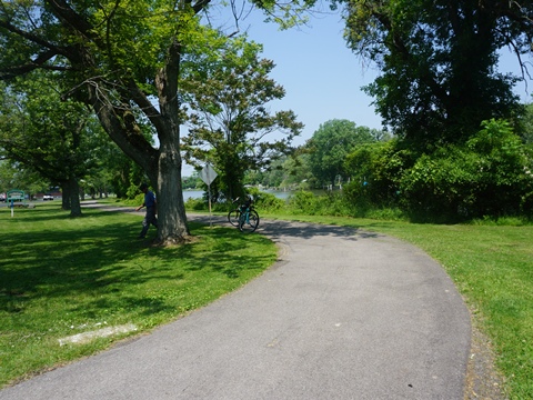
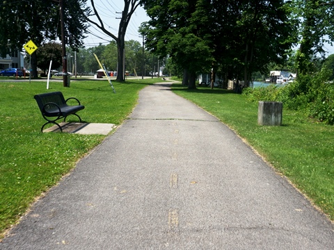
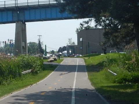
Some Views Along the Trail
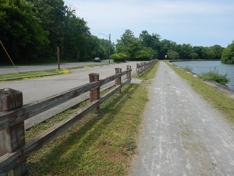
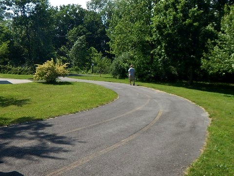
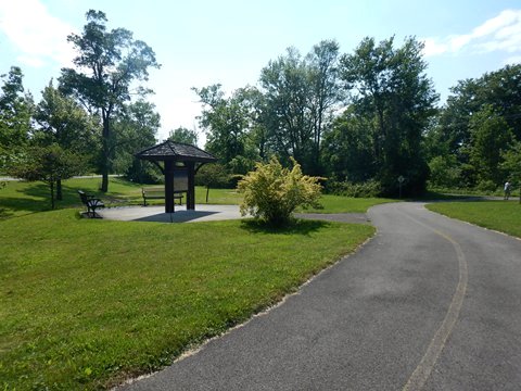
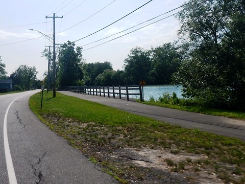
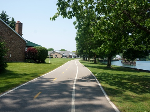
The trail between Amherst and Tonawanda is paved, mostly off-road with some sections roadside. Parking/trail access points along the way are located at a roadside park at Ransom Creek (parking, picnic) and at Amherst Veterans Canal Park (parking, restrooms, picnic).
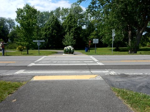
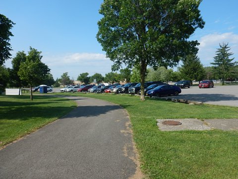
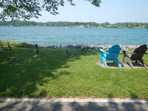
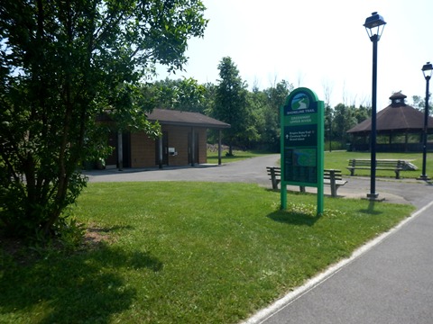
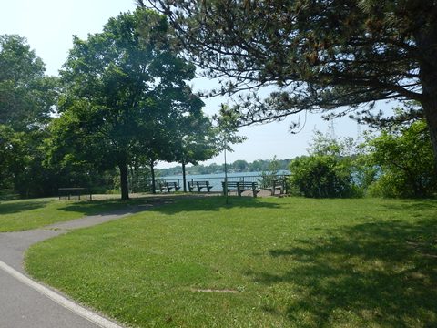
Ellicott Creek Park
Scenic Ellicott Creek Park lies at the border of Amherst and Tonawanda, with parking, restrooms, picnic areas, playgrounds multiple sports fields, Dog Bark Park, and more. The trail runs along the canal through the park, with links to 15 miles of park trails.
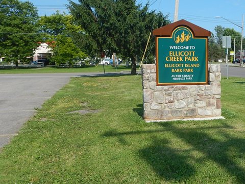
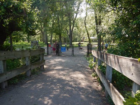
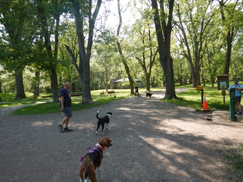
The Bark Park is on Ellicott Island, cross
footbridge over the canal.
More information .
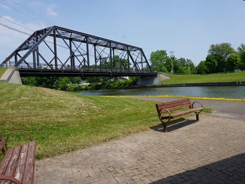
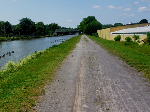
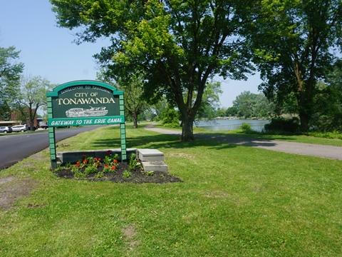
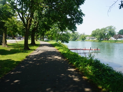
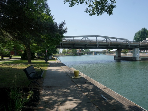
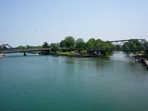
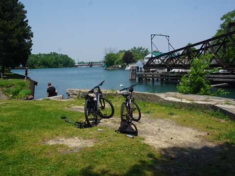
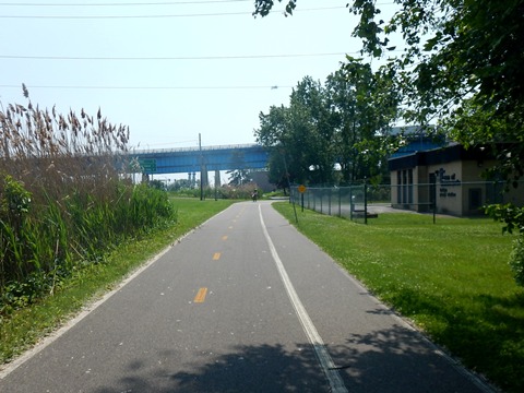
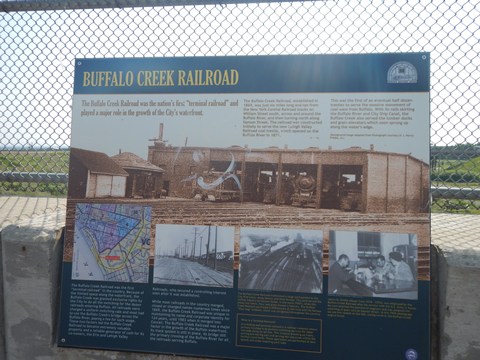
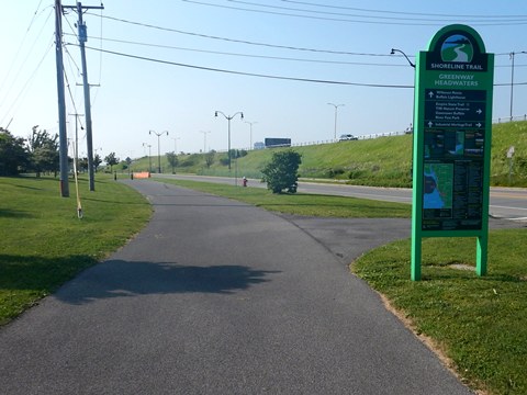
City of Tonawanda (mile 348)
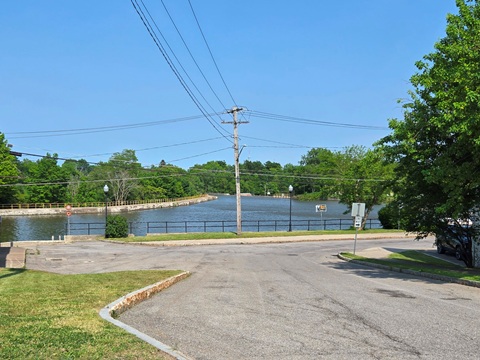
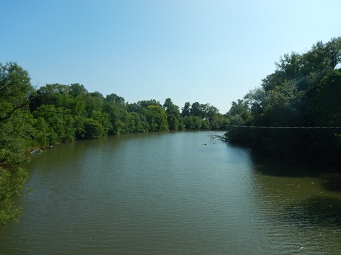
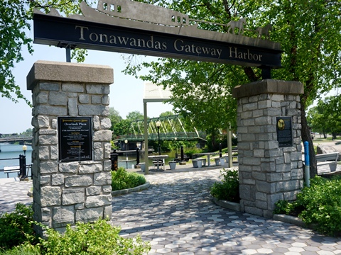
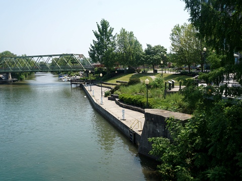
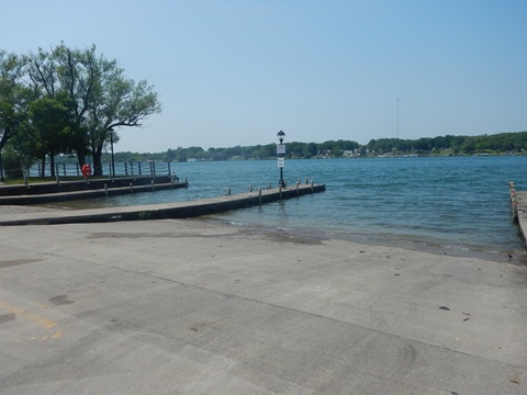
Tonawanda and the twin city of North Tonawanda played key roles in the development of the Erie Canal and westward expansion, serving as a transportation hub and Gateway to the Great Lakes. The Erie Canal ends/begins in Tonawanda at Gateway Harbor where it meets the Niagara River, which is the border with Canada. Many interpretative signs tell the story. This completed the link to Lake Erie - navigation continues to Buffalo along the Niagara River.
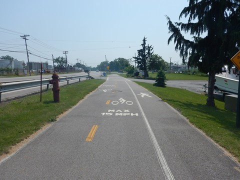
- We highlight *A Suggested Ride* here on the Shoreline Trail. Paved and easy to ride, the 4 mile multi-use trail is easy to ride and scenic, with interesting sights and history.
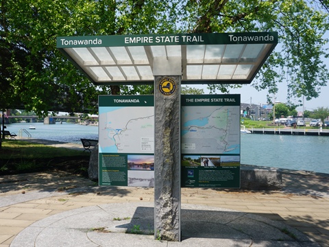
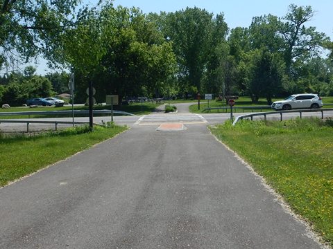
Ellicott Creek Park to Gateway Harbor Park (3 miles)
Along Creekside Dr.
The trail continues through Ellicott Creek Park along the south shore of the canal, alongside Creekside Drive. Leaving the park, the area becomes residential. The trail along Creekside Drive includes sections that run on the road shoulder. Creekside Drive becomes E. Niagara St. about a mile after leaving the park, and the trail leaves the road.
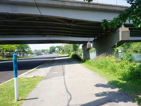
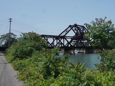
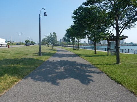
Along E. Niagara St.
Along Niagara Street is more urban, with residential and commercial areas. The road is busier, but the trail is well separated, with parks and scenic water views - an easy ride. Past the railroad bridge is a park with parking, picnic tables and benches. Niagara St. ends at the SR 384 bridge (crossing to North Tonawanda). The trail continues under the bridge.
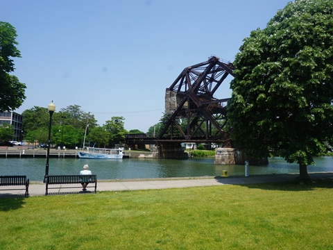
To Gateway Harbor
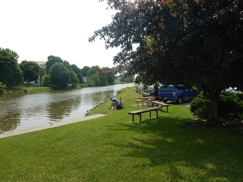
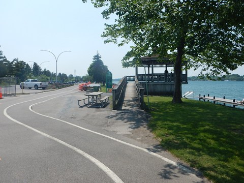
Past Delaware St. the trail passes the Long Homestead Historical Museum (1829), then crosses Ellicott Creek to Canal Street Plaza (pavilion, benches, canal views), and Gateway Harbor Park. These are part of Tonawanda's old waterfront district renewal, a popular hub for community events, with walking paths and docks. Nearby food, shops.
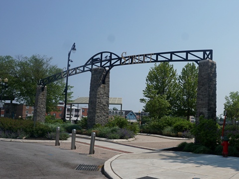
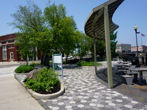
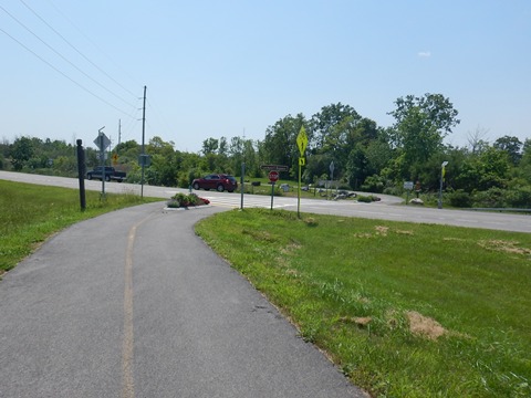
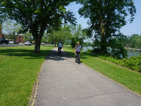
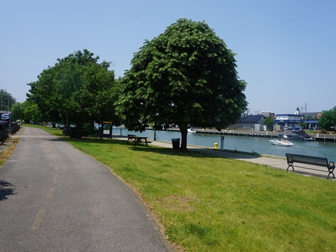
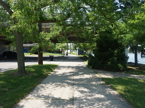
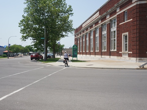
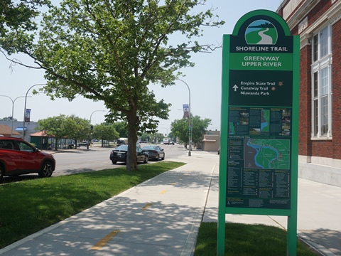
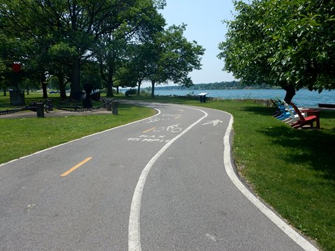
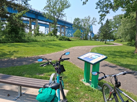
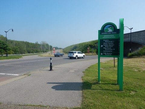
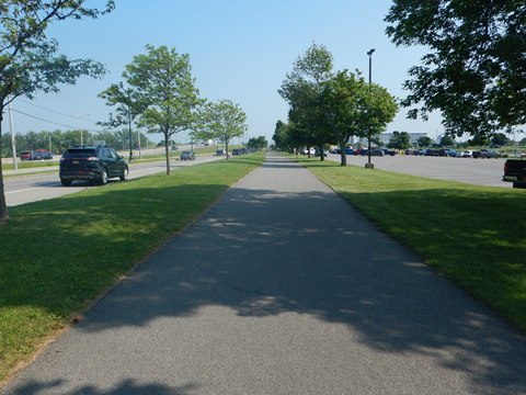
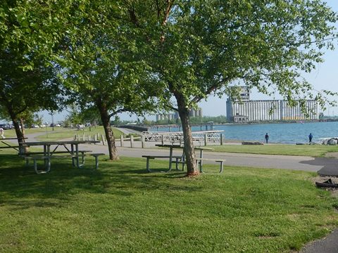
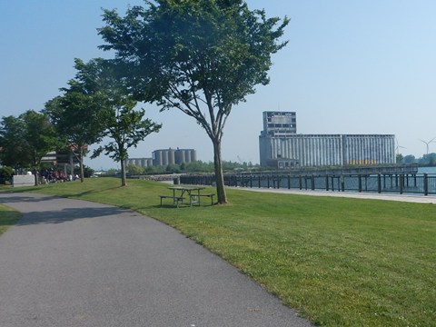
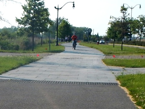
Shoreline Trail (4 miles)
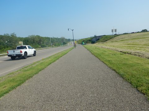
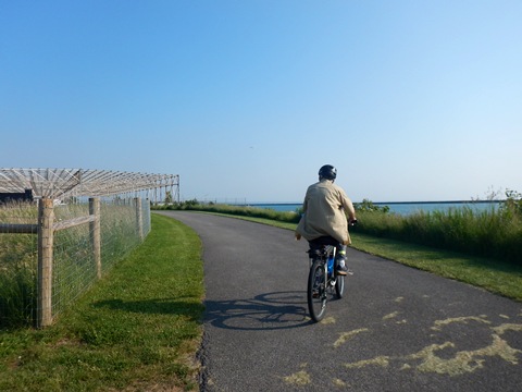
*A Suggested Ride* The Shoreline Trail runs from Tonawanda to Buffalo. The paved, off-road path follows the Niagara River, part of the Empire State Trail / Erie Canalway Trail. We much enjoyed riding a 4-mile section at Tonawanda. Following the shoreline, it's our favorite type ride - paved, easy to bike, scenic, with interesting sights and history.
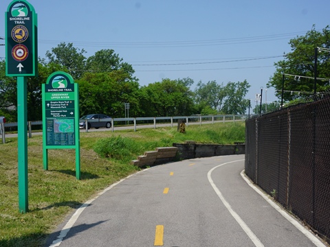
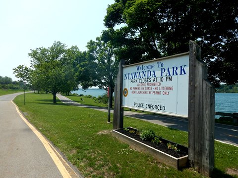
Gateway Harbor to Niawanda Park
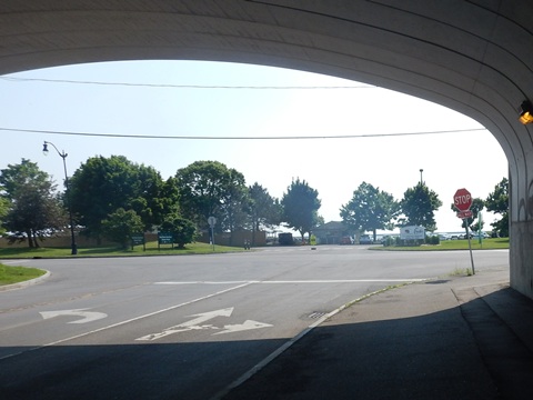
- Crossing Main St. past Gateway Harbor Park, the Shoreline Trail starts along Niagara St. At SR 265, it curves around to go under the road, then follows the canal to the juncture of the Niagara River.
- The trail continues as a comfortable ride on the paved multi-use path hugging the Niagara River shoreline. It passes some homes, then enters scenic Niawanda Park.
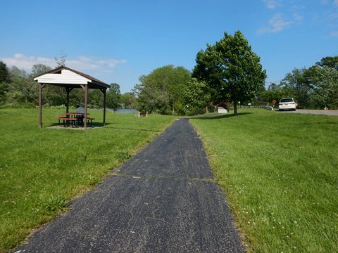
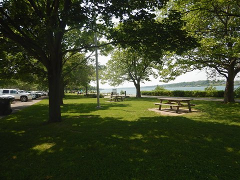
- The park is a local oasis with ample parking, restrooms, picnic tables, playgrounds, sport facilities, fishing piers, boat access, band shell and lots of green space. Interpretive signs detail canal history. The Ronald J. Pilozzi Pavilion in the park hosts private events as well as concerts, festivals, and public gatherings.
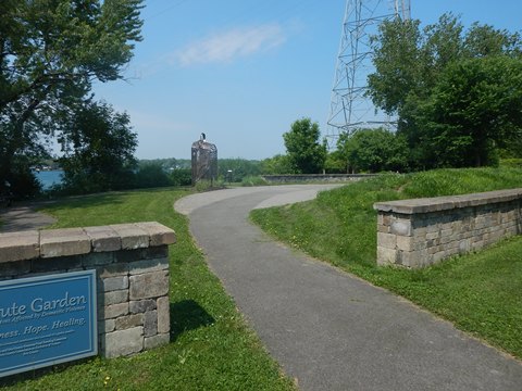
Isle View Park to Grand Island Bridge
- Crossing the bike/walk bridge over Two Mile Creek, the trail continues through Isle View Park. The park is across from Grand Island, the largest in the Niagara River.
- Isle View Park has parking, restrooms, picnic area, and playgrounds. It's popular for fishing, with free boat launch. The Tribute Garden, featuring the Valere Passage, honors lives affected by domestic violence.
- Leaving the park, the trail runs closer to River Road, past industrial facilities, to the Grand Island Bridge which carries I-190 over the river to Grand Island. The bridge replaces the ferry that once was the only access to the island.
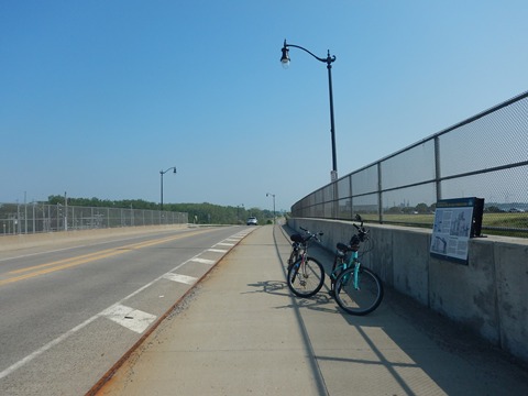
Grand Island Bridge to Buffalo Harbor State Park
We viewed short portions of trail at each end.
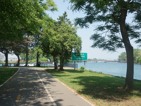
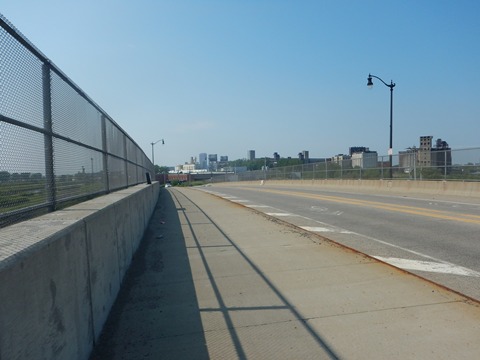
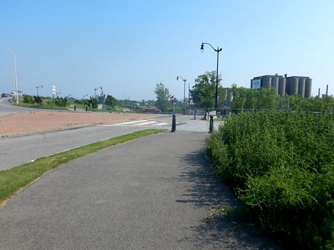
Past the Grand Island Bridge
After going under I-190, the trail continues through an industrial area along River Road to Buffalo. Parts of the trail run alongside I-190 with wide medians and barriers, but constant traffic. In town, other portions run along urban streets on protected bike tracks. Past the Peace Bridge (connector to Canada), the Niagara River flows into Lake Erie.
Approaching Buffalo Harbor State Park
The Buffalo River starts at the Canalside area in Buffalo, and the trail continues along the river. Running alongside Ohio St. it leaves downtown, crosses over the CSX rail yard and under SR 5 (the Buffalo Skyway, part of the Great Lakes Seaway Trail, a National Scenic Byway), to Buffalo Harbor State Park.
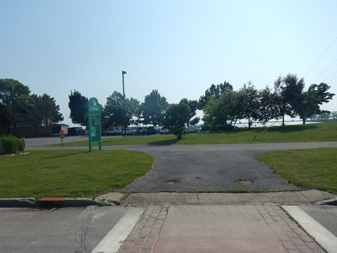
Buffalo (mile 364)
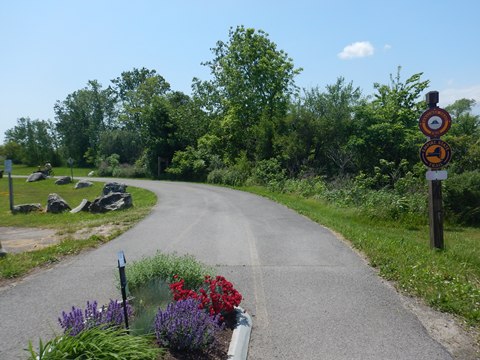
Buffalo Harbor State Park - Industrial Heritage Trail
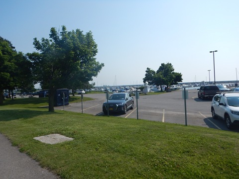
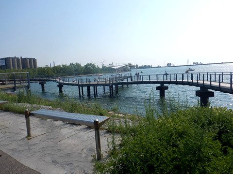
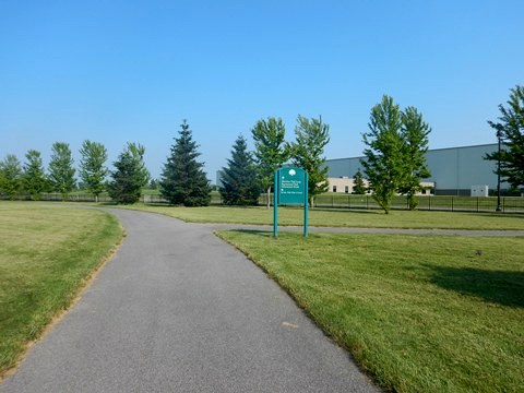
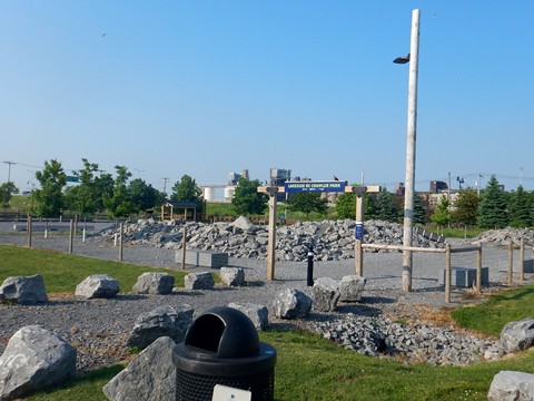
We visited the very end (or start) of the Erie Canalway Trail / Empire State Trail / Shoreline Trail at Buffalo Harbor State Park. This area is at Buffalo's Outer Harbor along Lake Erie. This location made it a key gateway for shipping between the Great Lakes and Erie Canal, with Buffalo developing as a major industrial hub in the 19th and early 20th centuries. Now redeveloped into a recreational and cultural center, the Outer Harbor has historical exhibits plus visitor amenities including parks, parking, restrooms, walking and biking trails, bike/kayak rentals, event space, public art, food and beverage options, and more. Buffalo has done a great job transforming this old, formerly blighted industrial area!
- We highlight *A Suggested Ride* here on the Buffalo Industrial Heritage Trail, which is a portion of the Shoreline Trail. Paved and easy to ride, the 3.5 mile multi-use trail follows an abandoned CSX railroad right-of-way from Times Beach Nature Preserve at the north, through Buffalo Harbor State Park, to the Urban Ship Canal at the south. Along the way, the trail highlights Buffalo's waterfront history.
We visited a 2-mile segment of the trail.
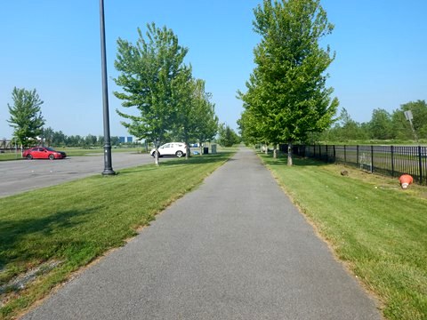
Starting at Buffalo Harbor State Park we first went south, then north. The trail runs lakeside along Fuhrmann Blvd., with access to the parks, historic exhibits, and other facilities along the way. Wide medians buffer the road from the trail. The Buffalo Skyway (SR 5) runs on an elevated roadway across Fuhrmann. Our focus being on the lakeside, we didn't find it distracting.
Buffalo Harbor State Park south to Urban Ship Canal
Buffalo Harbor State Park
- The trail runs along the Lake Erie shoreline past Buffalo Harbor State Park - the first state park in Buffalo, established in 2014. Abundant parking is trailside. The park includes restrooms, picnicking, biking and hiking trails, playground, restaurant, 1100 slip marina, the Gallagher Pier (picnic, fishing, views) and Gallagher Beach.

Tifft Street Pier to Urban Ship Canal
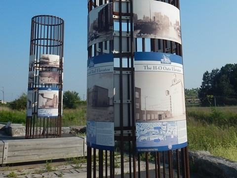
- Continuing past the park, the Tifft Street Pier features a pedestrian boardwalk and pier. Floating ramps provide access to a fishing dock at water level. Views include nearby wind turbines, and abandoned grain elevators (remnants of Buffalo's industrial past).
- The trail crosses Tifft St. and runs between Fuhrmann Blvd. and SR 5. At the canal, cross Fuhrmann to the canal and an exhibit area.
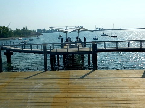
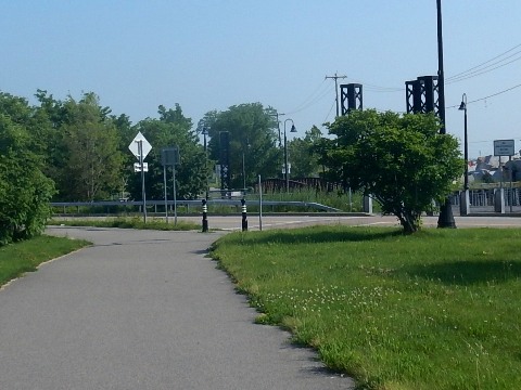
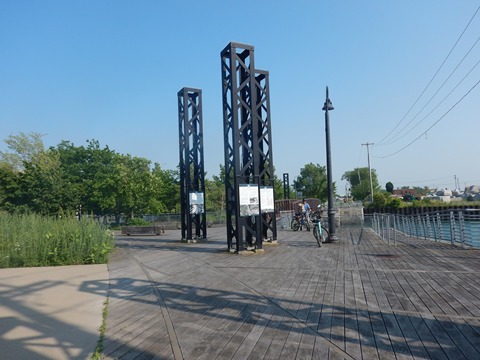
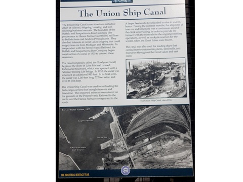
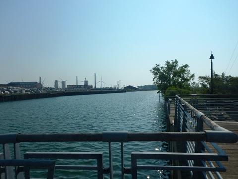
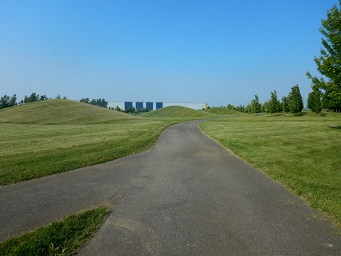
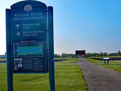
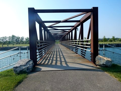
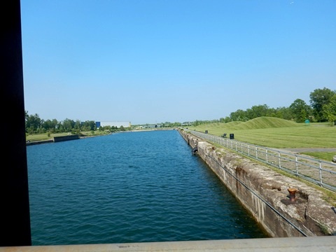
Urban Ship Canal and Ship Canal Commons (+/- 1 mile)
We extended our ride here to see more of the Urban Ship Canal. From the exhibit area, a bridge crosses the canal, then the trail goes along the canal under SR 5 to Ship Canal Commons.
- The Urban Ship Canal (1903) was built to support waterfront industries including steel and lumber. Once surrounded by blast furnaces, ore docks, and rail yards, today it's the site of Buffalo Lakeside Commerce Park.
- The Ship Canal Commons, former site of the Hanna Furnace Factory (1902-1982), is now a public park with 2 miles of multi-use trails circling the canal, parking, fishing access and interpretative historic signs. Midway through the park another bridge crosses the canal, connecting to the trail on the other side and shortening the loop.
Buffalo Harbor State Park north to the Lakeside Complex
North from the park and continuing alongside Fuhrmann Blvd. the trail continues as an easy ride.
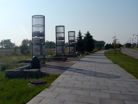
- The trail passes through the Grain Elevator Plaza. The displays are designed to reflect the area’s many grain silos. Signage with maps tells the story of the historic nearby grain elevators.
- We passed but did not visit the Terminal B Event Center, which hosts concerts, festivals, and community events. On a former industrial site, an abandoned warehouse was used as the framework for a new performance venue.
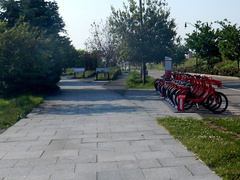
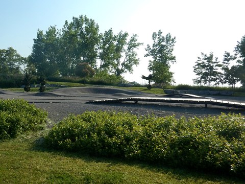
- The Lakeside Complex was the end of our ride, featuring the Lakeside Bike Park (3 mountain bike tracks, pump track, skills loop and tot track, bike rentals). The complex also includes nature habitats, the Lakeside Lawn events area, Food Truck Plaza, picnic area, and RC Crawler Park. Other trails winding through the area give scenic lake views.
Note: The trail ends in another 1.5 miles at the mouth of the Buffalo River. This section, which we have not visited, includes Wilkeson Pointe (parking, restrooms, lakeside trails, restaurant, kayak rentals, beach volleyball), and Times Beach Nature Preserve (trails, wildlife, bird watching).
This ends our exploration to date of the Erie Canalway Trail and nearby places of interest in the West Section.
RETURN TO ERIE CANALWAY TRAIL OVERVIEW
Copyright © BikeTripper.net. All Rights Reserved. Have Bikes - Will Travel