Bike Tripper
Have Bikes, Will Travel
Bike Trail Maps & Photos Galore
You are here > Home >
Great Allegheny Passage
Reported: June 2018
Great Allegheny Passage (GAP)...
A Great American Bike Ride
The Great Allegheny Passage spans 150 miles between
Pittsburgh, PA, and Cumberland, MD, encompassing a large swathe of
American history
 along the way. This is a rail trail,
built on old railroad lines, and as such is mostly flat. At Cumberland, the trail meets
the C&O Canal Towpath for another 184 miles to Washington DC
- a popular 334-mile multi-day ride, we met several groups making that trek.
We biked 35 miles of the GAP from Meyersdale, PA, to Cumberland, MD.
(Detailed map and photos below.)

Location: Pittsburgh, PA, to Cumberland, MD (See map)
Distance: 150 miles
Surface: Clay and crushed stone. Paved sections at
Pittsburgh and Cumberland.
Support and Advocacy:
GAP Conservancy 
Bike Shops/Rentals:
Find bike services here 
Shuttle:
Trail Inn
 (reasonably priced and accommodating)
Bike Tours:
Bubba's Pampered Pedalers 
Page Summary:
- Bikng the Great Allegheny Passage
- GAP in Pennsylvania
- Meyersdale to Salisbury Viaduct - Mile 32-35
- Meyersdale to Deal - Mile 32-25
- Deal to Mason-Dixon Line - Mile 25-20.5 - GAP in Maryland
- Mason-Dixon Line to Frostburg - Mile 20.5-15
- Frostburg to Cumberland - Mile 15-0
- Cumberland - Mile 0 - More Information and Resources
Biking the Great Allegheny Passage... Comments and Photos
Here we visit 35 miles along the GAP from Meyersdale, PA to Cumberland, MD. In this section, the trail was mostly flat with only a slight 1.5% grade approaching the Eastern Continental Divide. From the Divide, it was then mostly downhill to Cumberland. While not paved, the crushed stone surface is well maintained and fairly smooth, suitable for most type bikes. Two negatives - not show-stoppers, it's still a great ride: (1) the vegetation along the trail was very thick and blocked much of the view, and (2) it's very popular, with road bikers whizzing by - you need to keep watchful.
GAP in Pennnsylvania
Meyersdale to Salisbury Viaduct - Mile 32-35
From the Meyersdale Trailhead at the Historical Western Maryland Train Station - now a Visitor Center with interesting museum - we first biked north to the Salisbury Viaduct (mile 35 - 1,900 feet long over the Casselman River and US 219). We then returned south to Meyersdale, continuing on to Deal and back.
Meyersdale to Deal - Mile 32-25
In this section, significant historic features are (1) Bollman Bridge (mile 30.5 - a rare iron rail bridge built in 1871, it was moved to the present location on the trail in 2007), and (2) Keystone Viaduct (mile 30 - 910 foot curved railroad bridge over the railroad and Flaugherty Creek; built in 1911 as a double track, only one was used). This section is mostly flat.
Deal to Mason-Dixon Line - Mile 25-20.5
The next day we took a shuttle from Cumberland to Deal and biked 25 miles back. After the initial easy climb from Deal to the Continental Divide, it was mostly flat or downhill to Frostburg. Significant features in this section are (1) crossing the Eastern Continental Divide (mile 23.5) - at 2,392 feet, highest point on the trail; (2) riding through the Big Savage Tunnel (mile 22) - 3,295 feet long but paved and lighted.
GAP in Maryland
Mason-Dixon Line to Frostburg - Mile 20.5-15
The Mason-Dixon Line is at the border between Pennsylvania and Maryland. The 950-foot Borden Tunnel is shorter, but unlighted (mile 18). This section continued mostly flat or downhill to Frostburg.
Frostburg to Cumberland - Mile 15-0
The trail here follows the Western Maryland Scenic Railroad,
now a tourist ride running Thursday-Sunday. The trail in this section is downhill or
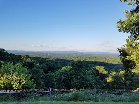
flat, an easy ride with more frequent panoramic views. Entering Cumberland
the surroundings become more urban. Other significant features are: (1) view of
Mt. Savage (est. 1780; in 1844, a mill here produced the first iron
railroad rail in the U.S.); (2) the 900-foot, unlighted Brush Tunnel
(mile 5 - shared by the train, keep out when a train is going through!), and (3) the
Bone Cave (mile 4). While there isn't much to see at the cave,
the history
 is interesting
- discovered during excavations in 1912, it contained 41 types of
mammal, 16% extinct.
Cumberland - Mile 0
The trailhead is at the historic Western Maryland Railway Station (1913), now a museum and visitor center. Connect here to the C&O Canal Towpath, continue another 184 miles to Washington, DC. Visit the shops and dining at Canal Place (also bike rentals) and in the Historic City Center, where Baltimore Street has been set aside as a pedestrian mall. Cumberland developed in Revolutionary times as a "Gateway to the West" and is listed on the National Register of Historic Places. It remains a vibrant town today.
More Information and Resources
More bike trails:
Bike-Maryland - see more information
about biking in Maryland
Bike-Pennsylvania - see more
information about biking in Pennsylvania
Related Resources:
GAP Conservancy -
Great Allegheny Passage 
National Park Service -
Potomac Heritage National Scenic Trail / Cumberland Coast 
Support and Advocacy:
GAP Conservancy 
Copyright © BikeTripper.net. All Rights Reserved. Have Bikes - Will Travel
