Bike Tripper
Have Bikes, Will Travel
Bike Trail Maps & Photos Galore
You are here > Home >
New York >
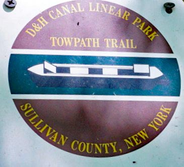
D&H Canal Towpath
Latest update: June 2022
D&H Canal Towpath...
Biking and Hiking along the D&H Canal, NY
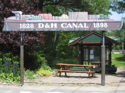
The D&H Canal ran 108 miles from Honesdale, PA, to Kingston, NY, built to carry anthracite coal to Hudson River markets. Operating from 1828-1898 it was an important part of transportation history, but abandoned as railroads grew. Today much has been filled in by man or nature, but some remnants of the canal, its locks and structures remain. Recreational trails for biking, hiking, horseback riding, and cross-country skiing now run in sections on the old towpath and on Ontario & Western (O&W) Railroad rights-of-way also paralleling the canal. (Detailed map and photos below.)
Biking & Hiking Map...
D&H Canal Towpath
View Larger Map - Sections covered in this report

See map of the entire Canal
Location: Sullivan and Orange
Counties, NY (See map)
Distance: Various, 1-6 mile sections in Sullivan
and Orange Counties
Surface: Gravel, grass, dirt
Trailheads/Parking: Bova Access, Summitville Access,
Hornbeck's Basin Access, Bashakill Wildlife Management Area, D&H
Canal Park, Port Jervis Branch Trail
Bike Shops/Rentals:
Action Bikes
(Port Jervis; sales, service, rentals)
Port Jervis
Bicycles (Port
Jervis; sales, service, rentals)
Page Summary:
- Biking the D&H Canal Linear Park Towpath Trail
- D&H Canal Linear Park
- Bova Road Access, Summitville Access, Hornbeck's Basin Access - Bashakill Wildlife Management Area
- Mamakating Environmental Education Ctr. - D&H Canal Park
- Neversink Valley Museum of History and Innovation - Port Jervis Trail
- Canal History
- More Information and Resources
Biking the D&H Canal Linear Park Towpath Trail... Comments and Photos
In New York, from north to south, we visited the D&H Linear Park (Summit County), Bashakill Wildlife Management Area (Summit and Orange Counties), and the D&H Canal Park and Port Jervis Trail (Orange County). The grass, dirt and gravel path can be rough biking - fat-tire bike or mountain bike recommended, we found the trail more suited to hiking. Interpretative signs and education centers along the way tell the story of the canal and the area history. No facilities except at trailhead parks. Bicycle helmets are suggested (required under 14).
D&H Canal Linear Park
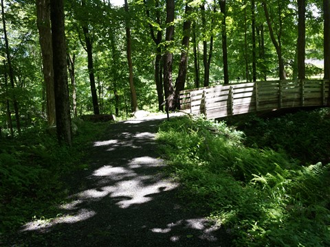
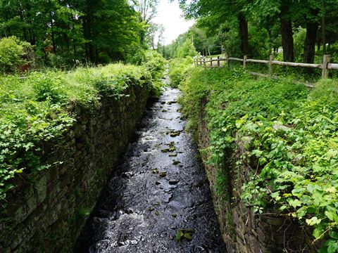
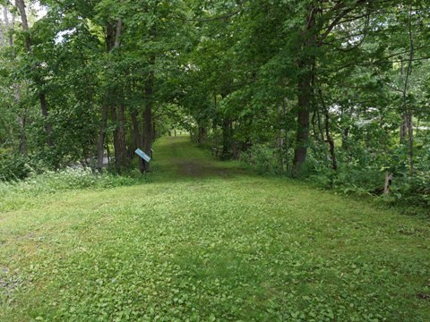
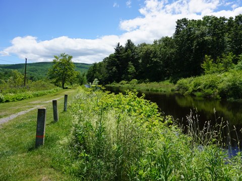
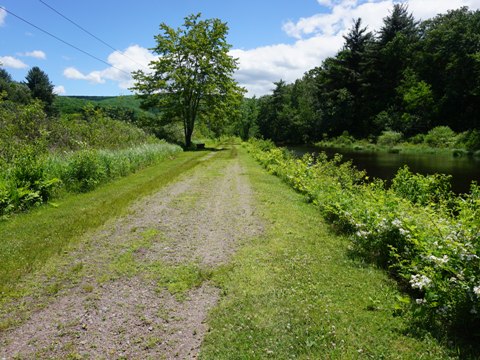
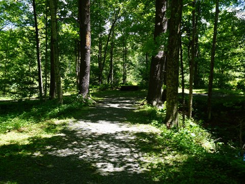
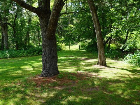
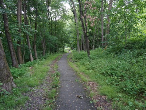
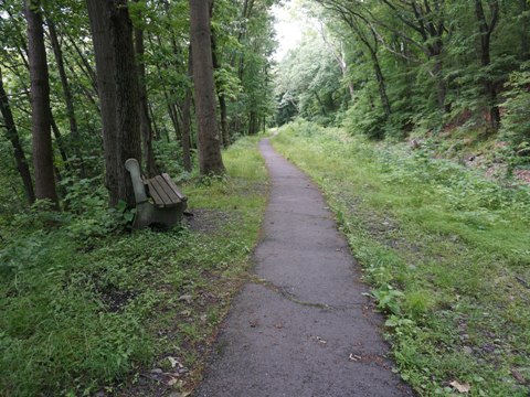
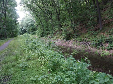
In Sullivan County, the 45-acre D&H Canal Linear Park runs about 4.5 miles from Summitville to Wurtsboro, paralleling US 209. This area is one of the few with sections of canal still filled with water. Interpretative signs are included along the way. The Towpath Trail is open to bicyclists, hikers, walkers, cross-country skiers and snowshoeing. Motorized vehicles and horses are prohibited. We visited three access points. This is grass and gravel - for us, better for hiking.
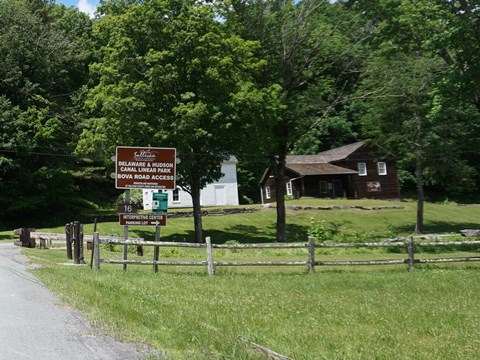
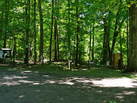
Bova Road Access
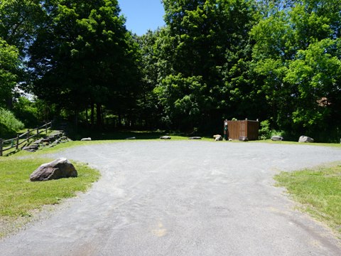
D&H Canal Interpretive Center
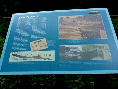
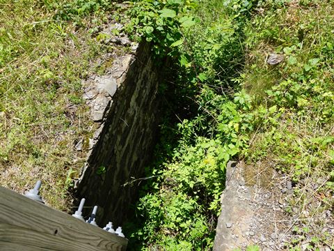
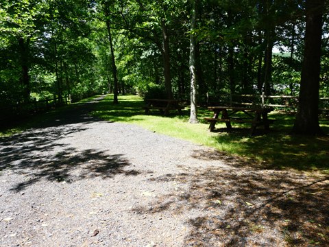
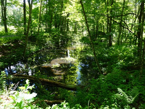
The D&H Canal Interpretative Center at the Bova Road access includes parking, restrooms, picnic tables, bookstore and historical exhibits. A section of canal exists here, including Lock 50, a dry dock, and waste weir. Interpretative signs tell of the workings of the canal. The path from the Center to the lock is gravel, the towpath trail along the canal was grassy (spring-summer).
D&H Canal Interpretive Center
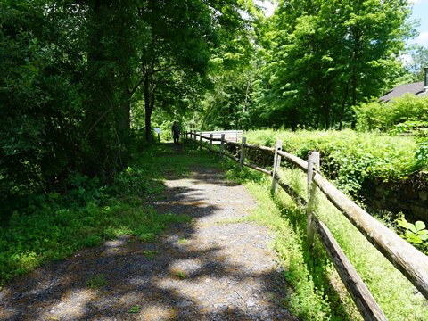
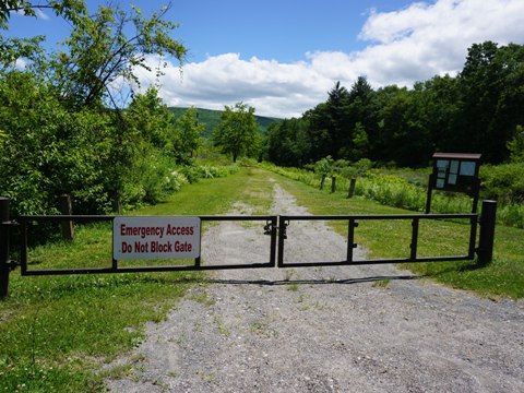
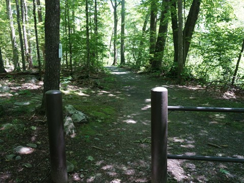
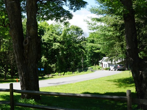
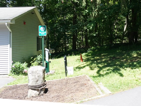
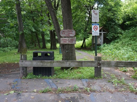
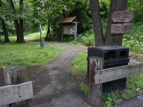
Summitville Access
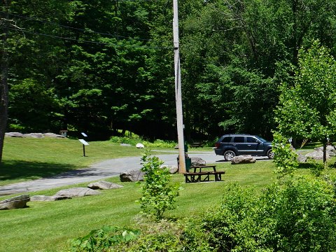
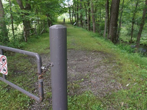
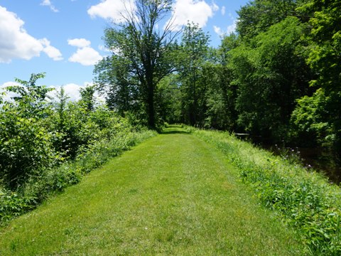
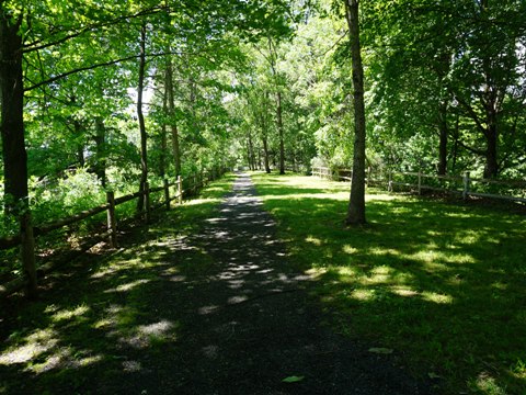
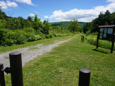
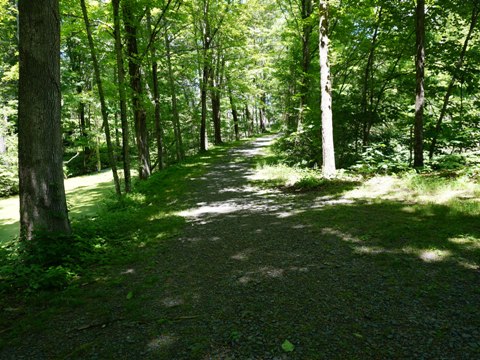
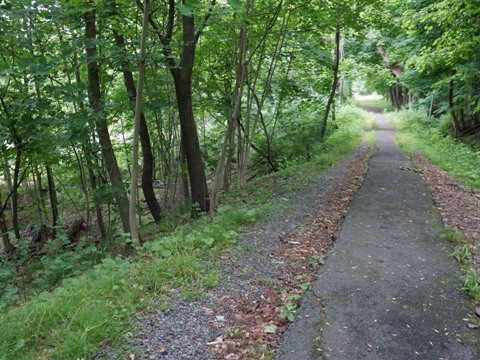
The Summitville Access is located off US 209 about one mile south of Bova Access, with parking, portalet and picnic. From the parking area a path goes up to the trail, from here the trail runs northbound. The trail here is gravel, but this is a pleasant shaded section. Looking across the road is the site of the Summitville station of the O&W Railroad - once a busy hub, it was known as "Grand Central Station."
To continue southbound, cross US 209 - the access point is about 400 feet to the right. The canal resumes here. The trail is gravel, no shade.
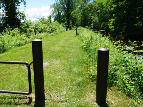
Towpath Trail at Summitville Access - northbound
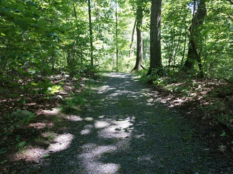
Hornbeck's Basin Access
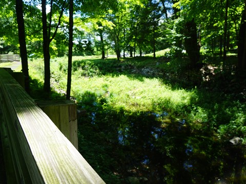
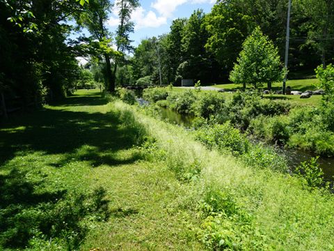
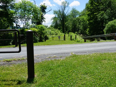
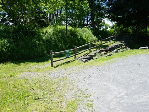
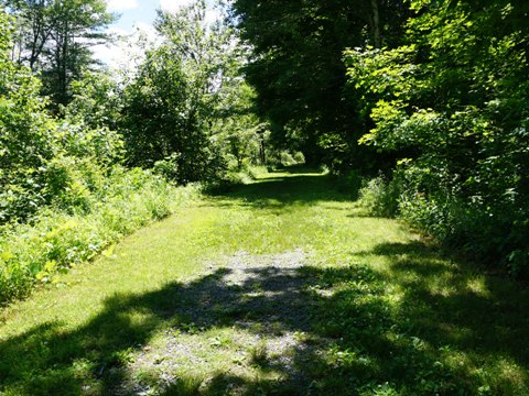
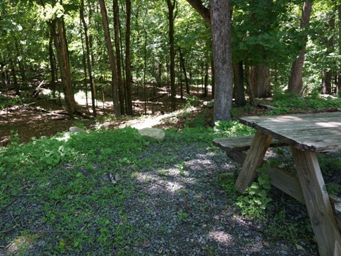
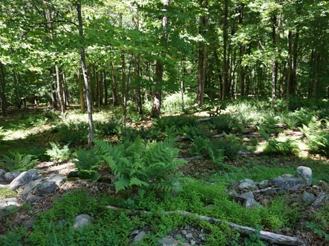
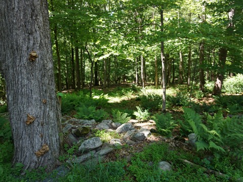
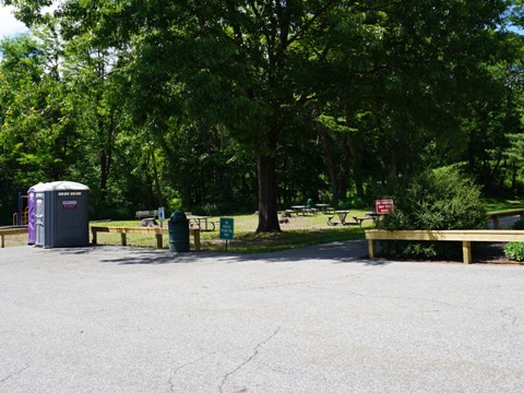
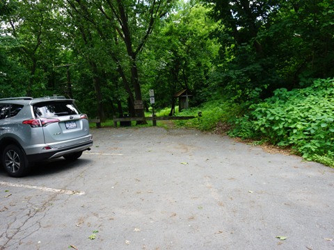
Hornbeck's Basin Access is along US 209 about 3 miles south of Summitville Access. Parking, portalet, picnic tables and grills are available. A 550-ft. gravel path leading to the towpath includes a bridge over the D&H Canal. The Towpath Trail here is grass and gravel, shaded.
Bashakill Wildlife Management Area
Bashakill WMA - Mamakating Environmental Education Ctr.
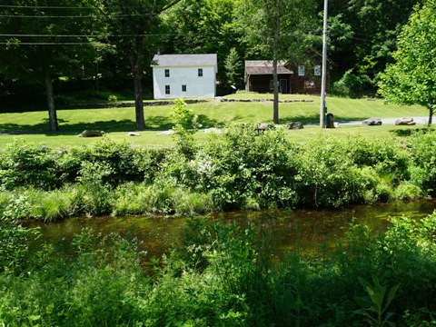
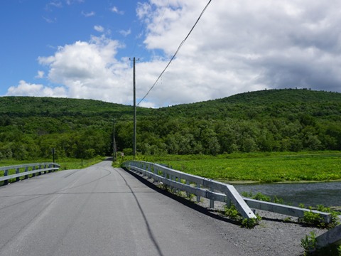
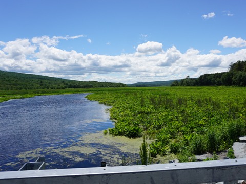
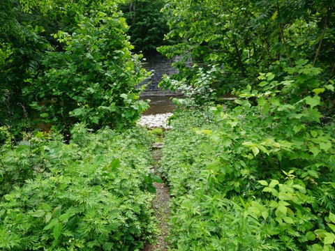
Bashakill Wildlife Management Area is located along the Sullivan/Orange County Line at Mamakating, NY, trail access is along US 209 about 4 miles south of Hornbeck's Basin Access. Covering 3,000 acres, it's the largest freshwater wetland in SE New York. There are 15 miles of trails, including a section of the D&H Canal Towpath and on the O&W Railroad railbed. A parking area is located along Haven Road about 3/10 mile from US 209 and the towpath. We didn't actually visit the trail here, but enjoyed some scenic views along Haven Road of the Basha Kill (stream/marsh) en route to the Mamakating Environmental Education Center on South Rd.(about 8/10 mile from US 209) (parking, restroom, picnic tables, hiking trails, and a bike repair station).
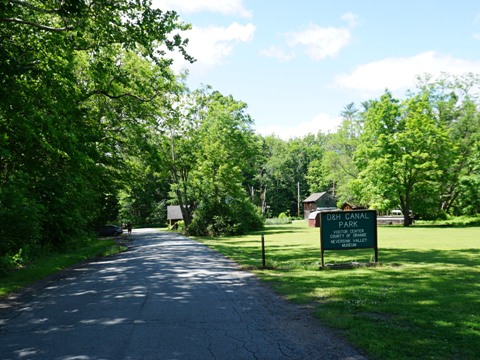
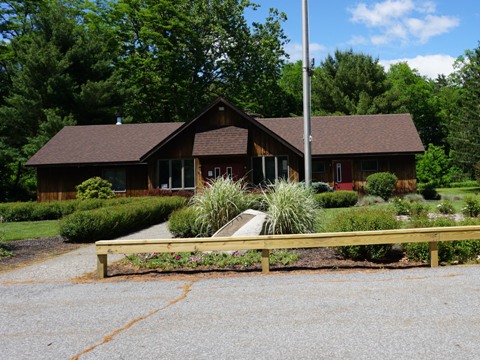
D&H Canal Park
D&H Canal Park - Cuddebackville
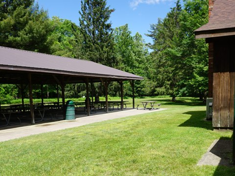
The 250-acre D&H Canal Park is located in Cuddebackville, NY (along Hoag Rd. off US 209, 7.5 miles south of Bashakill WMA). The Towpath Trail runs along the canal for about one mile on gravel - to reach the trail, cross Hoag Rd. behind the Visitor Center and go up the hill. Several locks remain, and a still water-filled section of canal. Canal Park includes parking, restrooms, Visitor Center, picnic tables, playground and fishing on the Neversink River. The footings of the Neversink Aqueduct (a cable suspension bridge that carried the Canal over the Neversink River) still stands. The Neversink Valley Museum of History and Innovation utilizes canal-era buildings including the Carpenter's House (Laura Murray Center, the main museum building with exhibits, store and office space), Blacksmith Shop and 1890's barn. In 1968, the National Park Service recognized the site as a National Historic Landmark.
D &H Canal Towpath Trail - Port Jervis
Port Jervis Towpath Trail
The City of Port Jervis has preserved a mile of canal, creating the Port Jervis Trail along the old towpath. A small parking area and information board are located at Main St. and Grand View Ave. The trail here is narrow (about 3 feet), but paved. The trail runs between the canal and a rail line - having been cut out of a mountain, it's about 100 feet above the track. The canal has been partially cleared, with work ongoing. Nearby, the appropriately named Canal St. was built over the original canal bed. The city is located at the convergence of the Neversink and Delaware Rivers, with an early industrial history as a shipping point for coal by canal and later by railroad.
Canal History
The D&H Canal was
envisioned by the Wurts family of Philadelphia in the early 19th century
as a means to transport anthracite coal from Pennsylvania to the Hudson
River and New York City. Constructed by the Delaware & Hudson
Canal Company from 1825 to 1828, it was one of the country's
first million-dollar private enterprises. With 108 locks and 16 miles
of gravity railway (a system for hauling coal over the Moosic
Mountains), it was considered an engineering marvel. The Canal's
history - and demise - is intertwined with the ascendance of railroading.
The canal was abandoned in 1898 as railroads grew and the Delaware &
Hudson Canal Company transitioned into a railroad company.
More detailed D&H Canal history
More Information and Resources
Nearby Biking:
Bike-New York
- More bike trails and information about biking in New York State
Related Resources:
Sullivan County NY -
Delaware & Hudson Canal Linear Park
Orange County NY -
Delaware & Hudson Canal Park
Support and Advocacy:
D&H Canal
Historical Society
D&H Heritage Corridor
Alliance
D&H Transportation
Heritage Council

Copyright © BikeTripper.net. All Rights Reserved. Have Bikes - Will Travel